
Capela de Nossa Senhora da Conceição da Lagoa
Rest stopObservedApproximate radius: 10 m
The white church with blue doors identifies the photographed start. Its OSM name is used as the landmark name.
-27.5982, -48.4679 · Observation date: · Source
Morro do Assopro trail to Costa da Lagoa: 11.5 km through forest, from the Lagoa church to the waterfall, with lookouts and a Cooperbarco boat back.
Illustration based on our photos of this route
A full day or hands on rock.
On this route

Morro do Assopro trail to Costa da Lagoa: 7.1 mi through forest, from the Lagoa church to the waterfall, with lookouts and a Cooperbarco boat back.
The Morro do Assopro trail guides we read start at Sertão do Assopro and stop at the Mirante da Florestinha. This route leaves from the church, passes the hang-gliding ramp, follows the ridge to Toca do Urubu and drops down the other side to the Cachoeira da Costa da Lagoa. We recorded the whole line with GPS, with photos for every stage below.
Last checked:
Aim to finish by
All these departures are public boat services. Confirm boarding and fare with Cooperbarco: these are departure times, not passage times at intermediate piers.
Board at Ponto 16 towards Ponto 1 in the centrinho. The walker reported a 30–40-minute journey.
Timetable: Cooperbarco boards, consulted 2 November 2026. Fares and journey time: walker, 1 November 2026.
Nobody has planned this trail for the next 7 days yet.
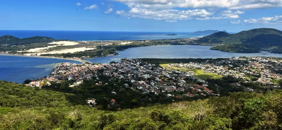
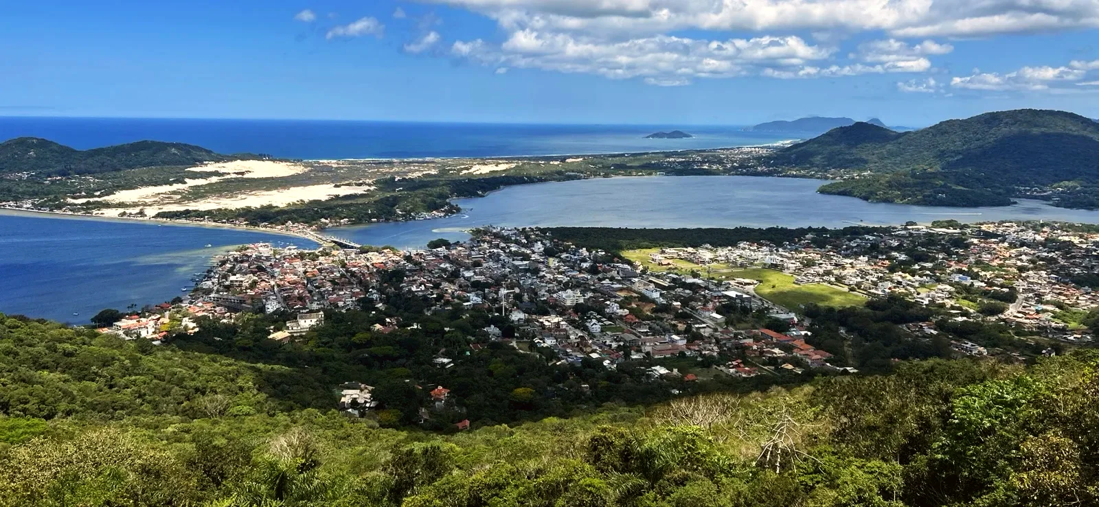
Leave from the Capela de Nossa Senhora da Conceição da Lagoa, the white church with blue doors at the top of the steps, built in 1780, listed in 1974 and a sanctuary since 1999. Just above it, the path crosses the Riacho da Igreja and enters the forest. After about 0.6 mi it reaches the Rampa Voo Livre: the lagoon, the dunes and the sea appear all at once. Hang gliders and paragliders have flown from Lagoa for more than 45 years, and the concrete hang-glider ramp stands on land of the Lagoa Clube de Voo Livre.
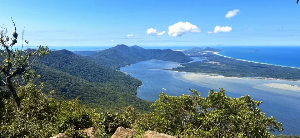
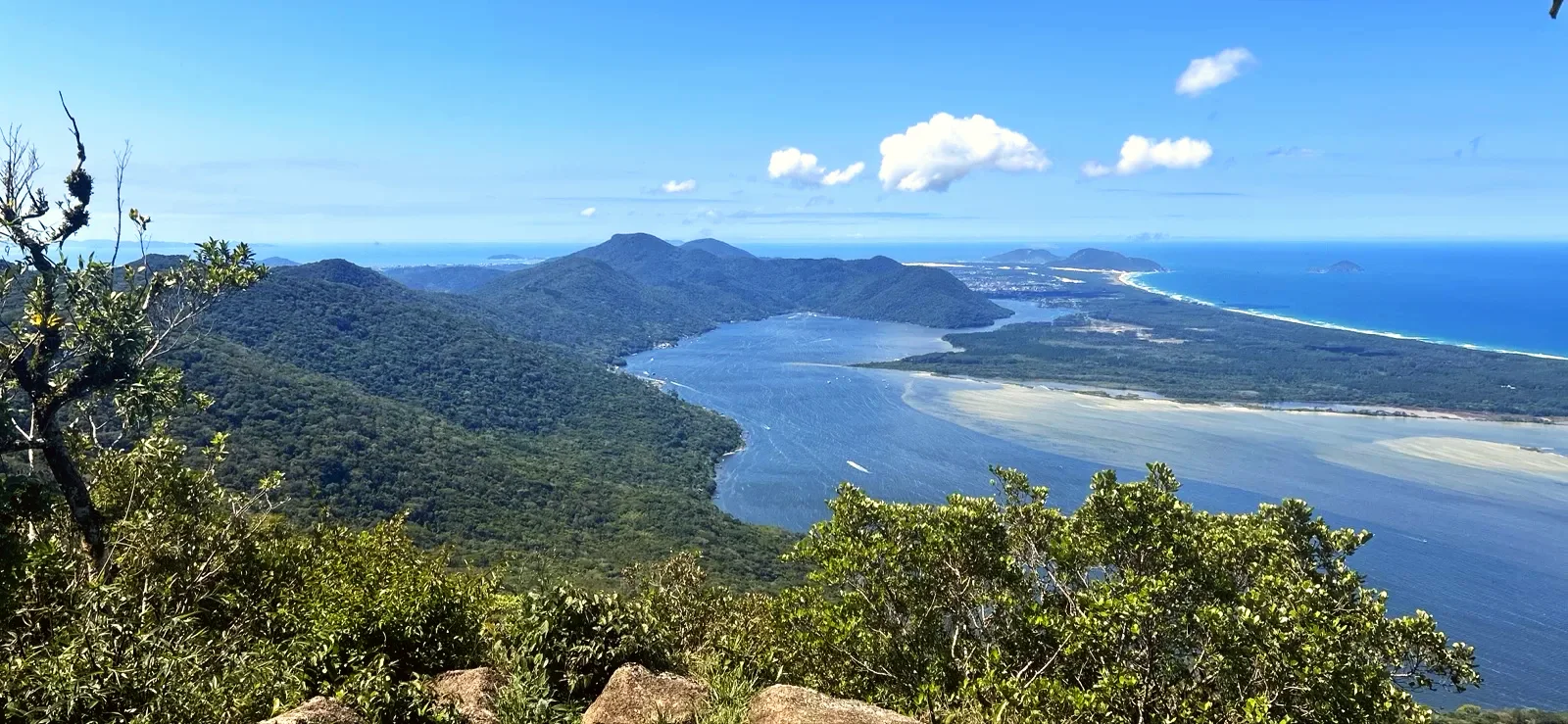
The climb heads north along the Travessão, over roots and granite slabs that get slippery after rain. Near 2.2 mi the forest opens onto the Cume do Morro da Lagoa, a rock slab with the whole Lagoa da Conceição below. It is the top of the Sete Voltas hill, well above the roadside lookout on the SC-404.
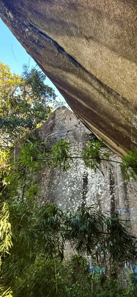
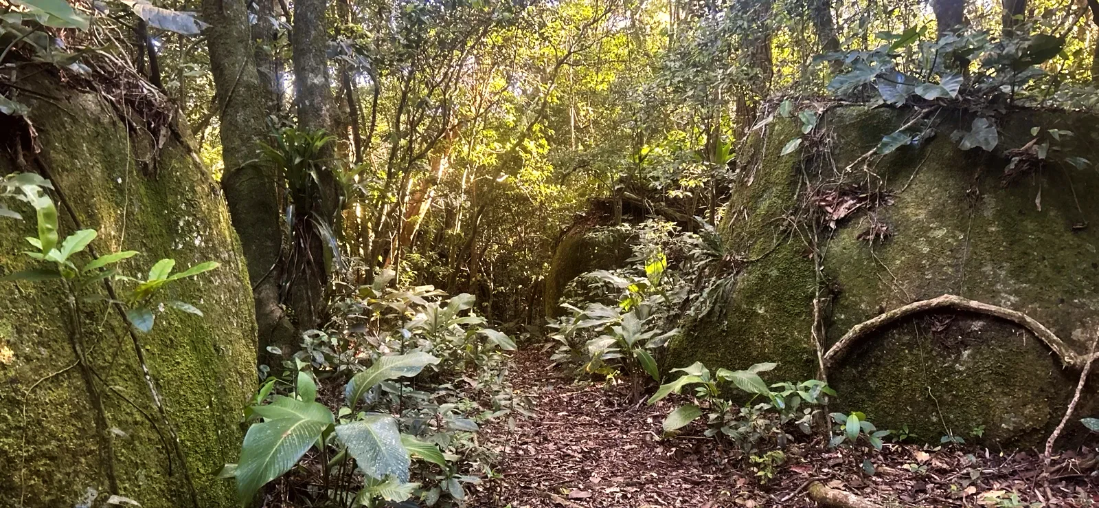
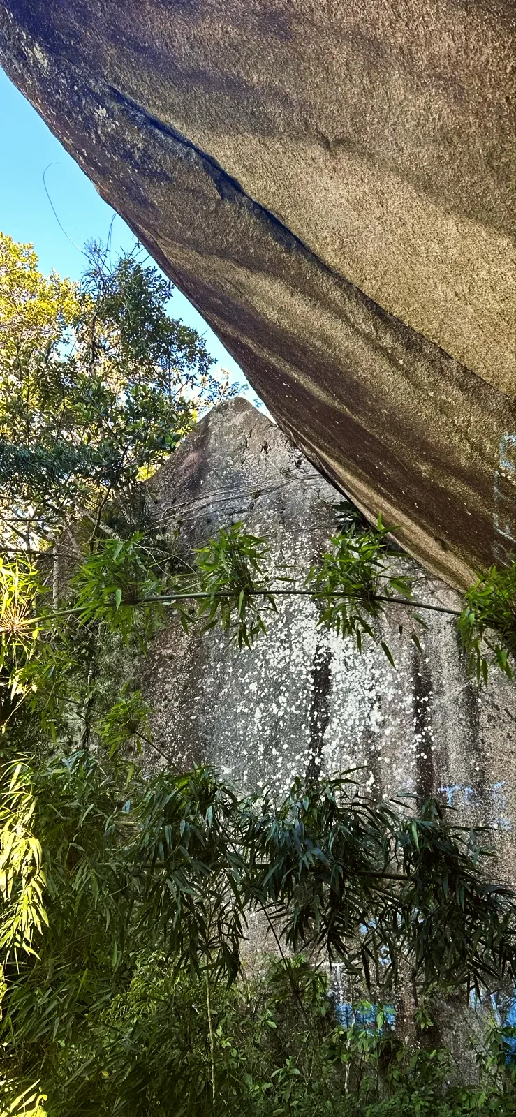
The path turns inland, past streams and huge granite blocks. Around 2.9 mi the Ribeirão Vadik runs beside the trail. At 3.7 mi comes Toca do Urubu: a leaning granite block with a narrow passage underneath and blue paint marks. Right next to it is the Improvised log crossing, an old log laid across a gap.
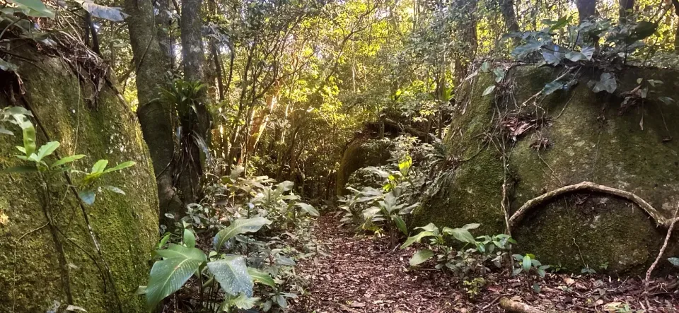
This is the longest stretch, almost all in shade, between mossy rocks and shallow streams. Near 5.0 mi the Rio Pau do Barco runs next to the line; Morro Manuel Lacerda rises about 390 ft from the trail, with no marked detour. A voice note at 5.2 mi records a step past the bend, and another at 5.7 mi a sharp left turn.
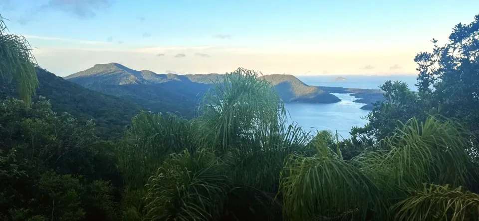
The narrow trail drops between palms and forest, and the lagoon comes back into view near 6.6 mi. Roots and loose leaves call for short steps.
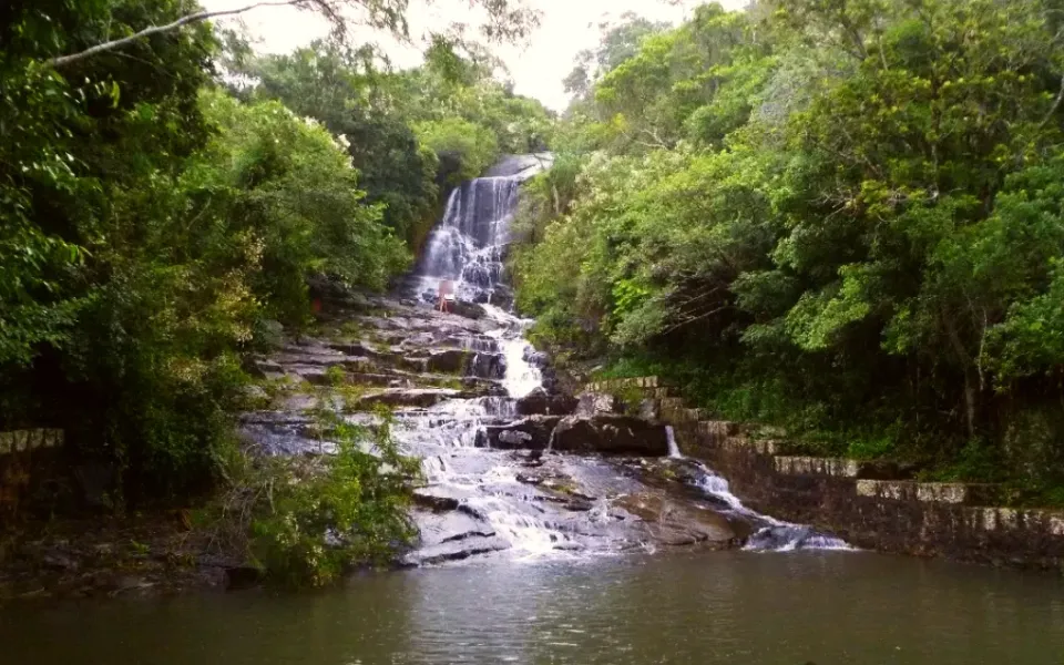
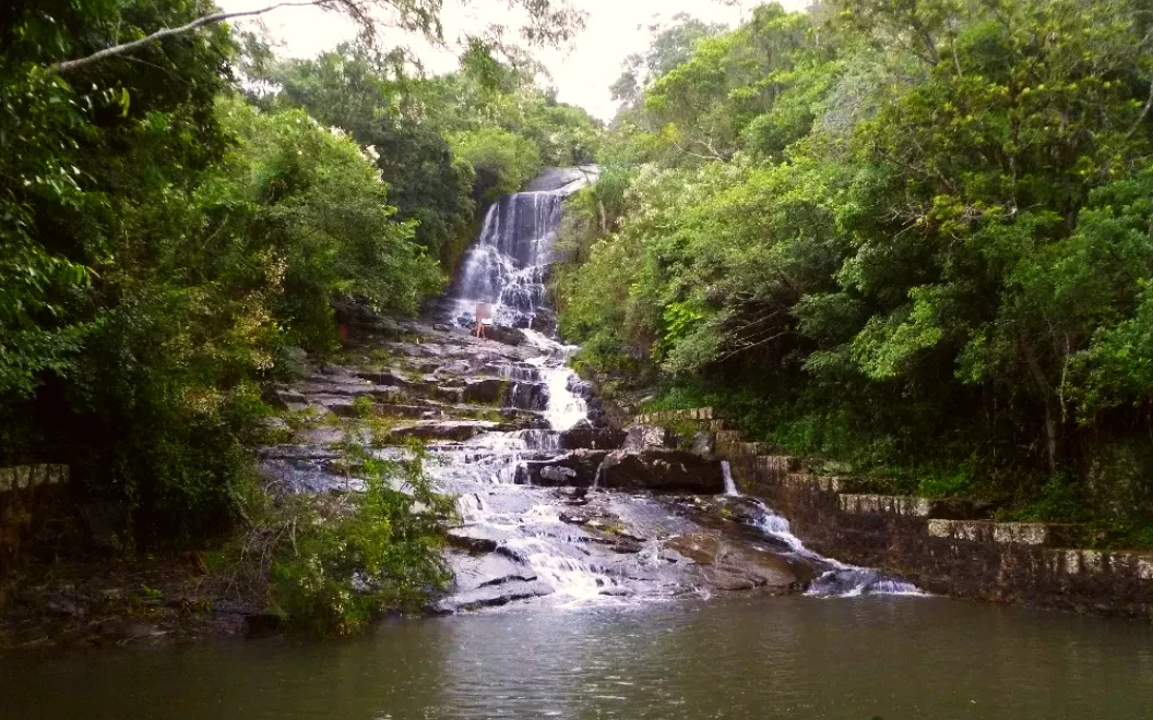
The fall is about 35 ft high with a dammed pool; on the day of the recording the water ran thin down the dark rock face. On the slab, a yellow sign warns: "LOCAL PERIGOSO" (dangerous place). The path ends at a wooden gateway in the village, close to Ponto 16: "Caminho da Costa da Lagoa — Refúgio de Vida Silvestre Municipal Meiembipe".
The start is the Lagoa church, in the centrinho of Lagoa da Conceição. The return is by boat, because the Costa da Lagoa village has no road: only trails and the lagoon.
Plan the day backwards from 18:00 at Ponto 16: half an hour of margin for the 18:30 departure. We checked the Cooperbarco boards on 2 November 2026. There was a public departure from Costa da Lagoa at 18:30 and another at 21:30 on weekdays (21:00 at weekends and on public holidays). Confirm with Cooperbarco on the day of your hike.
The walker paid R$15–20 per person on the shared boat and took about 30–40 minutes to Ponto 1 in the centrinho. A private boat cost R$150 for five people; another boatman asked R$200 for the group. Bars and shops in the village usually have a boatman's contact.
Our phone tested the internet along the way: there was a connection at the first lookout and at isolated points to the north, with repeated failures in the middle forest. Download the map and the boat times before you set off.
Carry all the water and food for the crossing, shoes with good grip, a headtorch, a power bank and long trousers for the undergrowth.
This traverse is not for small children or strollers. Teenagers used to long hikes go with an experienced adult and plenty of daylight. Avoid it after heavy rain.
The hills between Lagoa da Conceição and Costa da Lagoa lie in the Refúgio de Vida Silvestre Municipal Meiembipe, as the gateway at the end of the trail says. The city lists lookouts, springs, waterfalls, trails and hang-gliding ramps among the refuge's attractions.
The better-known Costa da Lagoa trail starts at Canto dos Araçás and follows the lakeshore. It is a different, lower path; its times and distances do not apply to this crossing over the hill.
7.5 mi · 3:40 h
7.5 mi · 3:40 h
Zoom in to see photo thumbnails. Nearby photos form groups; larger groups reveal more as you zoom.
Map data from OpenStreetMap. It loads as you scroll to it.
Swipe through the walk from start to finish; the open map follows each photo.
Phone checks and walkers’ reports: Internet 1.5 mi Unstable 1.1 mi No internet 1.1 mi No data 3.7 mi latest observation
Coverage depends on the carrier and the weather. Grey dots: no observations yet.
Access paths are gray, warnings red. Camera markers show where each photo was taken and which way it looks.
The map or its tiles are unavailable. Route coordinates and information remain available as text.
Places shown: 11
Rest stopObservedApproximate radius: 10 m
The white church with blue doors identifies the photographed start. Its OSM name is used as the landmark name.
-27.5982, -48.4679 · Observation date: · Source
Water pointPotentialApproximate radius: 10 m
Mapped stream near the lower approach. Not verified as drinking water or a maintained crossing.
A water point does not guarantee potable water or current availability.
-27.5963, -48.4684 · Source
ViewpointObservedApproximate radius: 10 m
Paragliding/hang-gliding launch site with a lagoon panorama. The ramp is the primary landmark; Morro do Assopro identifies the area. Flight operations and structural safety are not verified.
-27.5914, -48.4716 · Observation date: · Source
ViewpointObservedApproximate radius: 10 m
Open granite slab at the top of Morro da Lagoa (the Sete Voltas hill), with the whole lagoon in view. Higher than the ramp and than the roadside lookout on the SC-404.
-27.5755, -48.4717 · Observation date: · Source
Water pointPotentialApproximate radius: 10 m
OSM stream near the recorded line around 2.9 mi. Crossing conditions and potability unverified.
A water point does not guarantee potable water or current availability.
-27.5734, -48.4779 · Source
Bridge / footbridgeObservedApproximate radius: 10 m
The walker warned that the wood was unreliable. Check its current state and do not use unstable wood. No safe maximum load has been established.
-27.5672, -48.4815 · Observation date:
HazardObservedApproximate radius: 10 m
The trail passes under a leaning boulder; blue paint marks the passage.
-27.5671, -48.4813 · Observation date:
Water pointPotentialApproximate radius: 10 m
OSM stream near the recorded line around 5.0 mi. Crossing conditions and potability unverified.
A water point does not guarantee potable water or current availability.
-27.5545, -48.4780 · Source
PeakPotentialApproximate radius: 10 m
1 460 ft hill in OSM, about 390 ft from the trail near 5.2 mi; there is no marked detour to the top.
-27.5545, -48.4762 · Source
Water pointObservedApproximate radius: 10 m
Shallow water observed; not verified as drinking water.
A water point does not guarantee potable water or current availability.
-27.5456, -48.4793 · Observation date:
WaterfallObservedApproximate radius: 10 m
Thin cascade over dark granite on the field date. Slippery rock; keep back from the edge.
-27.5436, -48.4640 · Observation date:
Opens a 3D view with terrain from AWS Open Data, map tiles from OpenFreeMap and satellite imagery from MapTiler; these services receive your IP address.
The map or its tiles are unavailable. Route coordinates and information remain available as text.
Elevation estimated from open terrain data (Mapzen Terrain Tiles on AWS Open Data: SRTM, Copernicus and others).
Photos along the route. Open a photo to see it at full size.
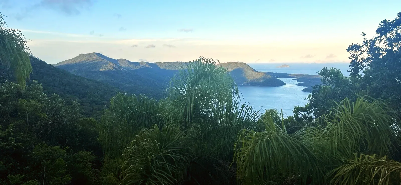
Lagoa da Conceição and the forested hills seen from the open rock lookout on the ridge.
The lagoon, village and pale coastal dunes below the Morro do Assopro launch area.
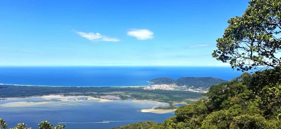
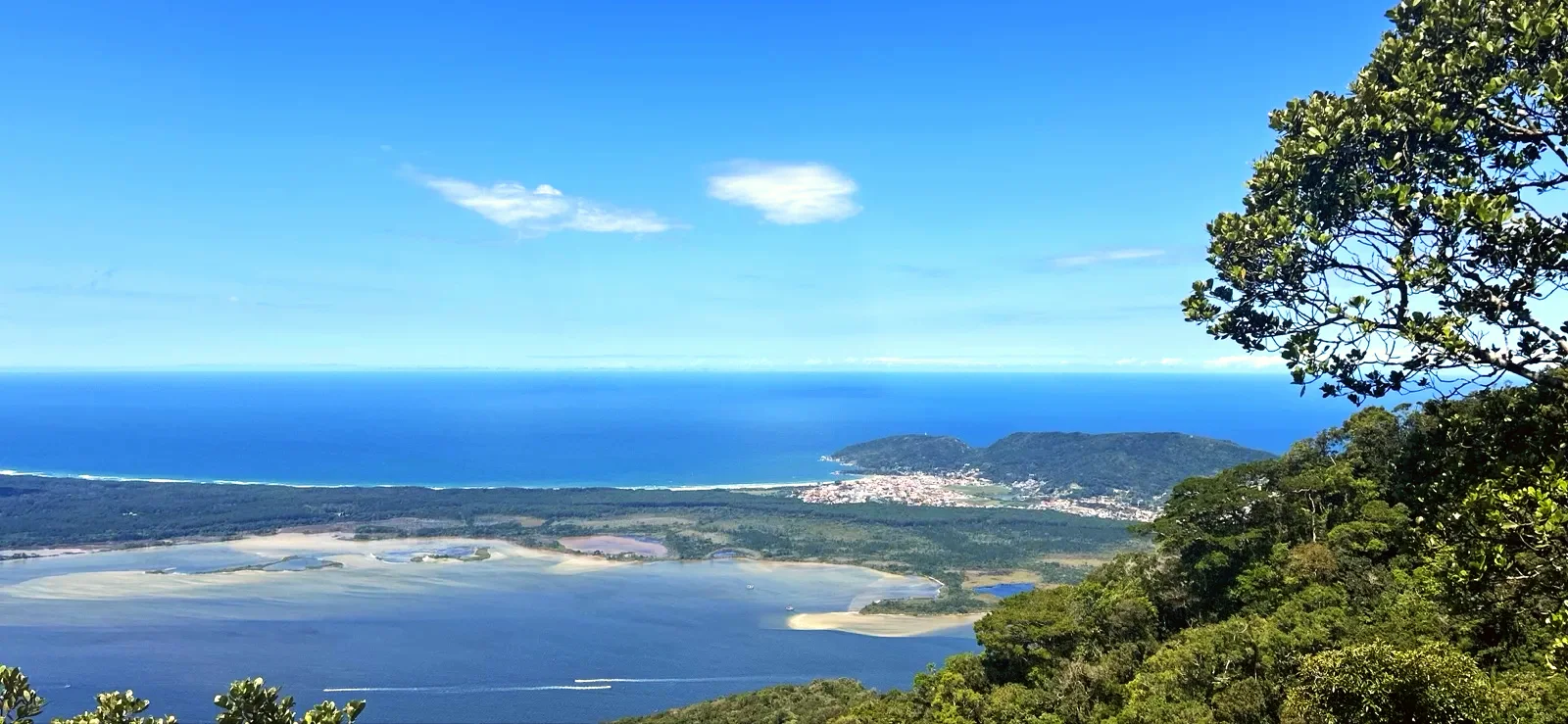
Shallow lagoon water, the coastal forest and the ocean beyond the eastern shore.
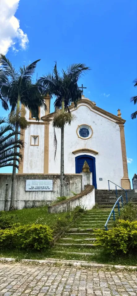
The white church with blue doors and stone steps at the start in Lagoa da Conceição.
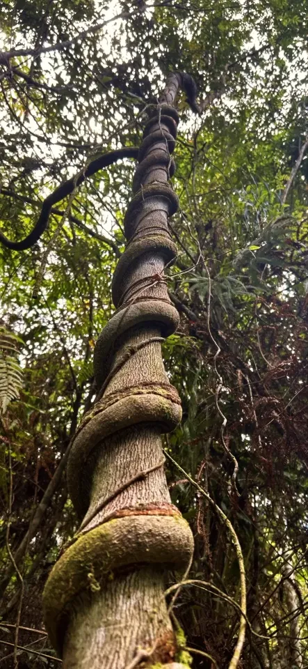
A thick vine coils around a tall tree trunk beside the shaded ascent.
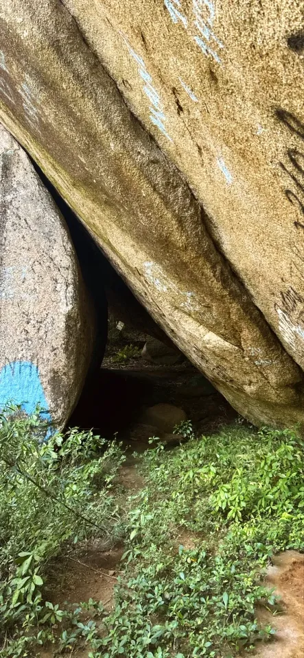
A narrow passage under a leaning granite boulder, with blue painted waymarks.
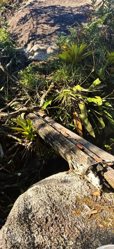
A weathered log spans a narrow gap between granite rocks on the forest trail.
The leaf-covered path passes between large mossy granite boulders in the forest.
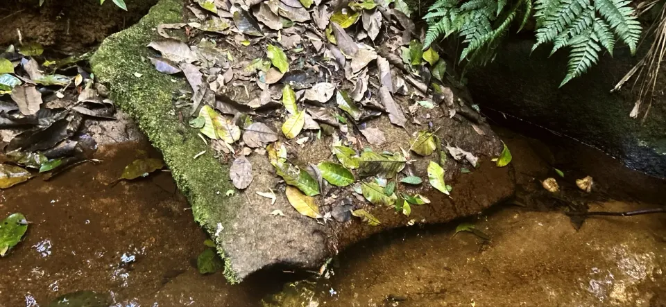
A shallow forest stream runs around a flat rock covered with fallen leaves.
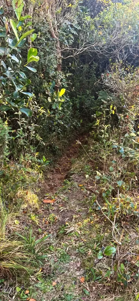
A narrow earth path disappears into dense vegetation on the northern forest section.
The lagoon reappears beyond palms and forest during the descent towards Costa da Lagoa.
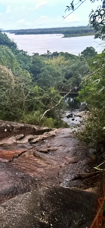
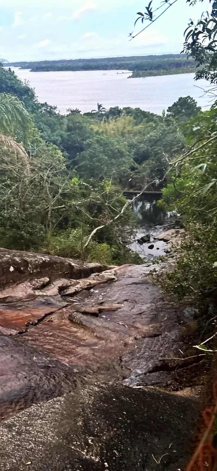
Water runs down a broad granite slab towards a small pool, with the lagoon beyond.
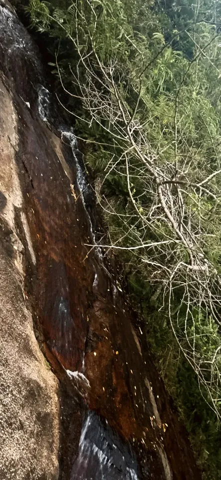
A thin cascade runs down the dark granite face at Cachoeira da Costa da Lagoa.
The immense overhanging granite face of Toca do Urubu towers above the forest path.
The stepped cascade and pool at Cachoeira da Costa da Lagoa. Provided image; capture date unknown.
Start at the Lagoa church, in the centrinho of Lagoa da Conceição. Finish in the Costa da Lagoa village and take the boat at Ponto 16 to Ponto 1 in the centrinho; the boat does not return to the church. Be at the pier by 18:00 and check the day's times with Cooperbarco.
Footwear with good grip, drinking water and food for the forest crossing, offline map, charged phone, power bank and headtorch. Long trousers help on overgrown ground; bring sun protection for the open lookouts.
Overgrown path, confusing forks, steep descent, wet granite, roots, streams and mud. The improvised log near 3.7 mi may be rotten: test it before crossing. Internet only in places; download the map. Leave the forest in daylight. Do not go alone. Emergency: SAMU 192, fire brigade (Bombeiros) 193.
7.5 mi · 3:40 h
7.1 mi on foot; the boat is separate. Reach Ponto 16 by 18:00. Cooperbarco shows a public departure from Costa da Lagoa at 18:30 and another at 21:30 on weekdays or 21:00 at weekends and on public holidays. Ponto 16 to Ponto 1: R$15–20 per person on the shared boat, about 30–40 minutes. Private boat: R$150 for five people; another offer was R$200 for the group.
Updated from the same shared observations as the map and app. Distances follow the main walk, including the return.
Internet reported at these distances from the start: 0 ft–0.7 mi; 2 mi–2.1 mi; 2.3 mi–2.4 mi; 2.6 mi–2.7 mi; 4 mi–4 mi; 4 mi–4.1 mi; 5 mi–5 mi; 5.6 mi–5.7 mi; 7.3 mi–7.5 mi.
Reports are observations, not a guarantee. Coverage varies by carrier and conditions. Download the map before leaving.
White church with blue doors at the top of the steps, in the Lagoa centrinho. The boat back arrives at Ponto 1, also in the centrinho.
Continue to Ponto 16 for the boat to Ponto 1. Arrive by 18:00 and confirm the day's times with Cooperbarco.
Parking and taxi information reflects the recorded observation. Check current access and prices before leaving.
No parking or taxi locations verified yet.
The recording took about 3.5 hours of walking and 7 hours in total with stops. At that pace, leave the church by 10:00 to reach Ponto 16 before 18:00.
Yes. The Cachoeira da Costa da Lagoa, about 35 ft high, is where this trail ends, a few minutes' walk from Ponto 16.
By Cooperbarco boat from the Lagoa da Conceição centrinho. The village has no road access.
No. That one follows the lakeshore; this one climbs Morro do Assopro and crosses the ridge.
The walker paid R$15–20 per person on the shared boat in November 2026. A private boat cost R$150 for five people.
Collect it in person in the Boramundo app at Rampa Voo Livre.
Mark a route after completing one full published walking option. Photos and GPS are not required. Repeats count once.
Sources and references: redeplanejamento.pmf.sc.gov.br, cooperbarco.wordpress.com, visitefloripa.com.br, portalelegis.alesc.sc.gov.br
In this first version, ratings are user opinions. Physical passage has not been verified.
Passage not verified
Recommends
See open group outings on this route or propose your own.
