
Ponte pênsil da Barra da Lagoa
Bridge / footbridgeObservedPoint
Blue footbridge from 2006 over the channel; start of the walk.
-27.5753, -48.4232 · Observation date:
The Barra da Lagoa natural pools trail runs 1.0 km, measured from the suspension bridge to the rocky shore, past the Prainha and through the forest, and takes…
Illustration based on our photos of this route
Short and flat. For everyone.
On this route

The Barra da Lagoa natural pools trail runs 0.6 mi, measured from the suspension bridge to the rocky shore, past the Prainha and through the forest, and takes about 25 minutes.
Nobody has planned this trail for the next 7 days yet.
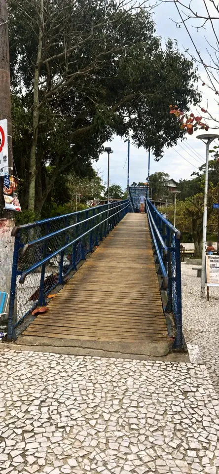
Start at the Ponte pênsil da Barra da Lagoa, the blue footbridge over the channel, next to the Igreja São Pedro and Praia da Barra da Lagoa. The name comes from an older bridge: the current walkway, metal with a wooden deck, dates from 2006, has a 100 ft central span and was renovated by the city in 2021.
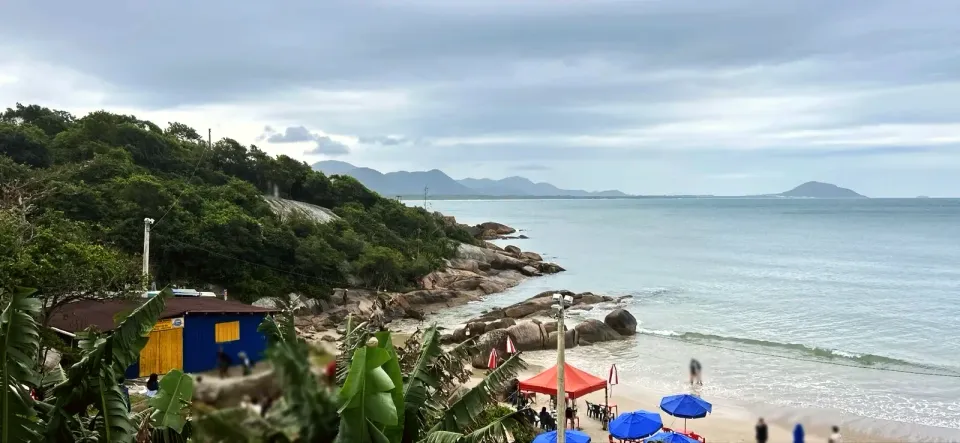
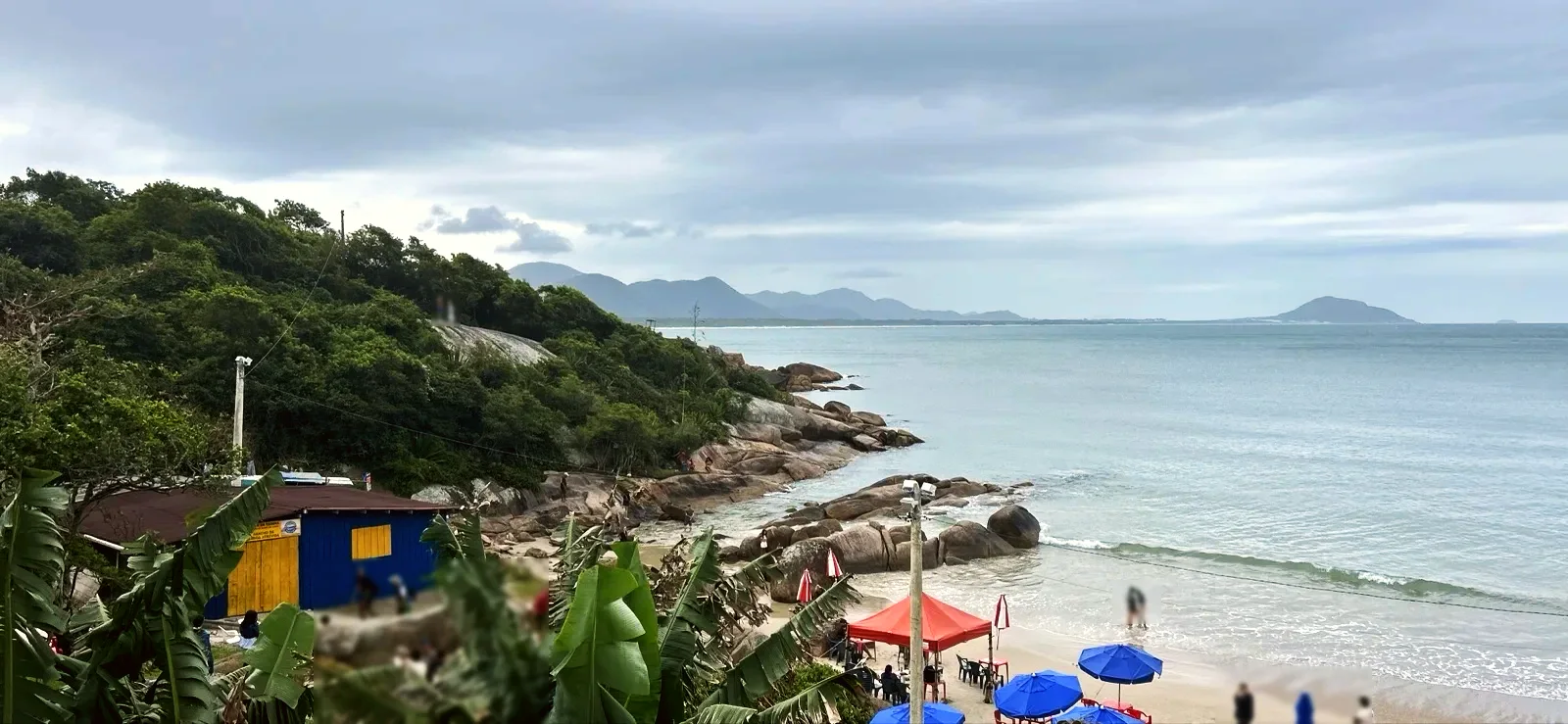
The tiled lanes run between walls, bamboo and gates and drop down to the Prainha da Barra da Lagoa: about 330 ft of sand between rocks, with kiosks and parasols on the day of our walk. The city lists the Prainha among the sights of the Monumento Natural Municipal da Galheta.
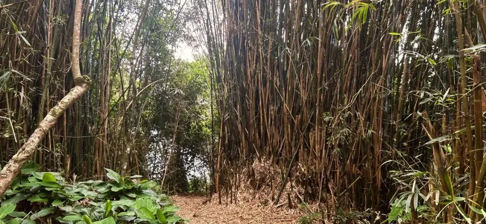
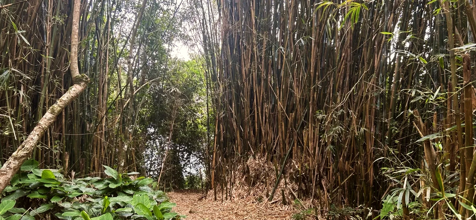
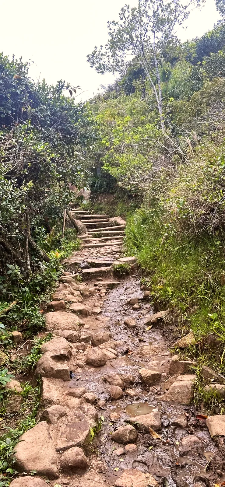
After the Prainha the path enters the forest. At about 1 310 ft the lighthouse trail climbs to the right up the hill; for the pools, carry straight on. Next comes a bamboo tunnel and a run of stone and log steps.
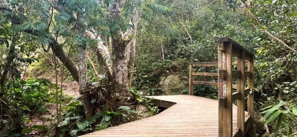
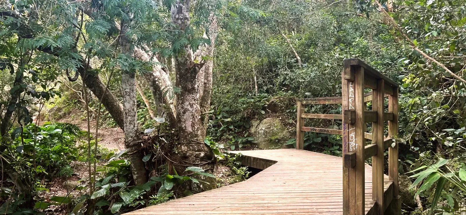
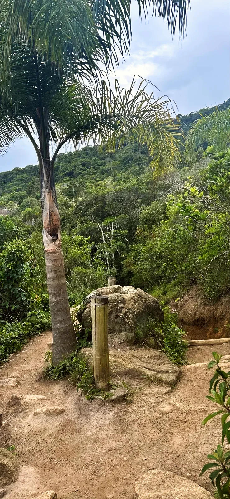
A palm beside a boulder marks the descent into a shady valley. There, a wooden bridge with a handrail crosses a small stream between mossy rocks.
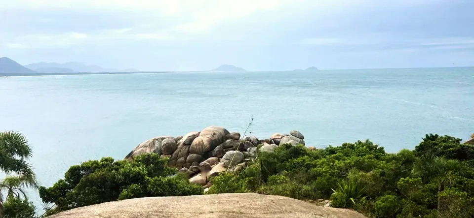
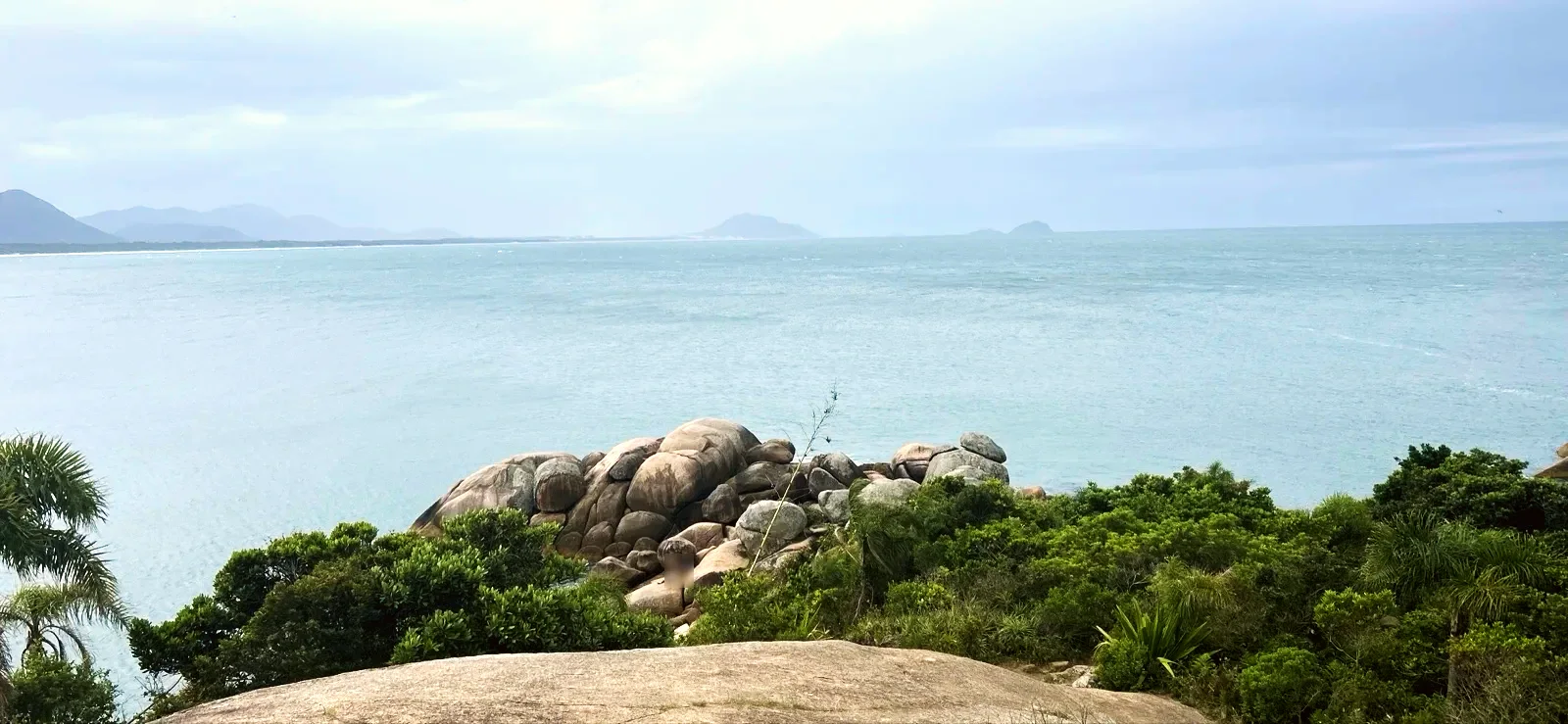
The path leaves the trees onto a wide granite slab, with the sea ahead and islands on the horizon. At the start of the slab, a yellow sign warns that there is no lifeguard here.
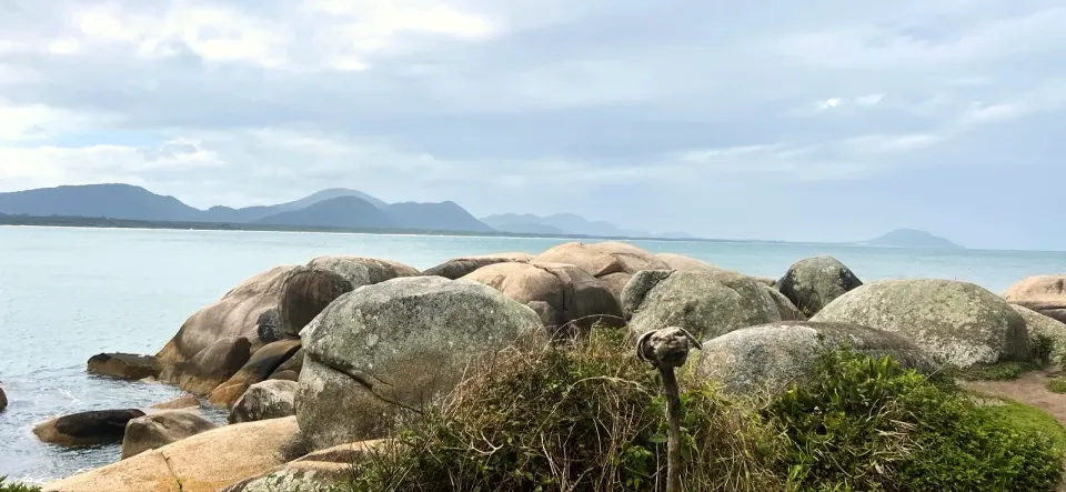
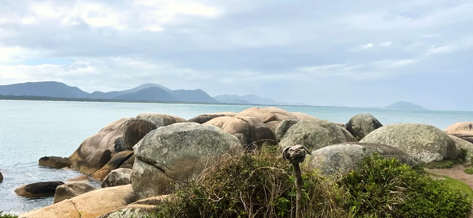
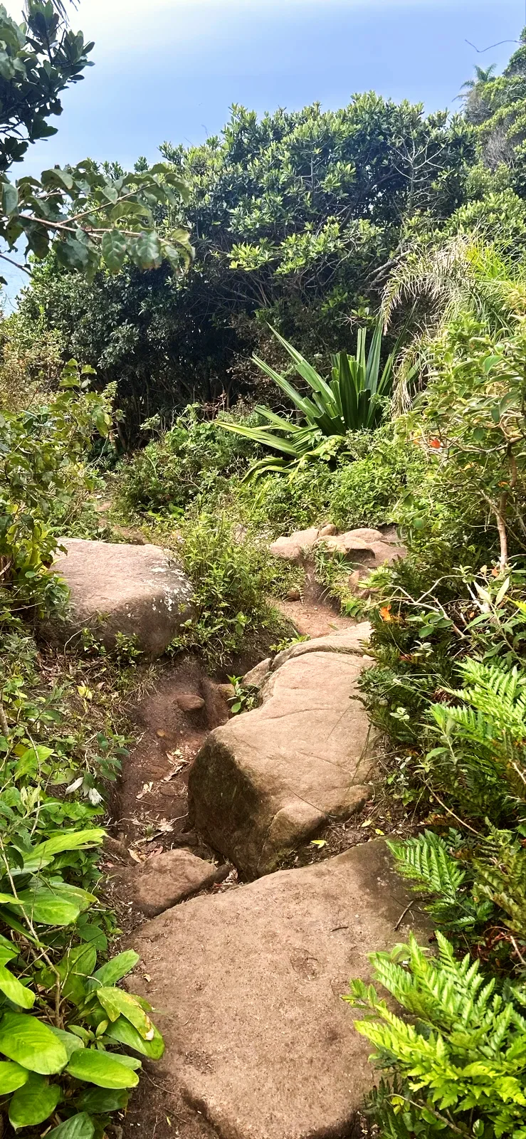
A short descent over large boulders leads to the rocky shore where the measured line ends, on the flank of Ponta da Galheta. It is not an enclosed pool: on calm days the water lies still between the boulders, but the shore faces the open sea.
The start is the suspension bridge at the end of Rua Amaro Coelho, in Barra da Lagoa. OpenStreetMap marks the Estação Barra da Lagoa bus terminus about 100 ft from the bridge and a public toilet next to it; we did not check routes, timetables, the toilet or parking. By bus, look up the Barra da Lagoa route on the city transport service before you set off.
By car or ride-hailing app, get out in the village: the bridge is for pedestrians and cyclists only.
The return is the same way back to the bridge. On the map, the there-and-back option uses the same recorded line in reverse; it is not a second recording. Leave the rocks with enough daylight for the steps in the forest.
The walk suits an adult with a baby in a sling or carrier and children from about 5 years old, holding hands on the steps and rocks. A pushchair gets stuck almost at once, in the stepped lanes and then in the forest. With a baby in your arms, go slowly on wet steps.
Even with the rocky shore in sight, the water is another matter: the guides we consulted do not recommend the pools for children, because of the rocks and the depth. Pick a dry spot on the lookout or on the high rocks and stay away from the wet edge.
Go on a day with a calm sea. With a north-easterly wind the sea turns rough, often within the hour, and the calm of the pools disappears. The sign at the start of the lookout is short and to the point: “ÁREA SEM GUARDA-VIDAS” (no lifeguard on duty).
In an emergency, call 193 (fire service) or 192 (SAMU ambulance). Tide and swell change the rocky shore from one day to the next; check the wave forecast before you go.
Bring trainers with good grip, water and sunscreen: there is no shade on the rocks. Mobile signal was excellent on the day of our walk, but it is worth downloading the route map. There is no drinking water along the way; fill up in the village.
The trail lies inside the Monumento Natural Municipal da Galheta, a protected area created in 1990 as Parque Municipal da Galheta and converted into a Natural Monument by Lei 10.100/2016. It covers 251 hectares of Atlantic Forest and coastal restinga vegetation between Barra da Lagoa and Praia Mole, managed by Floram, and is open to the public.
Floram lists the natural pools trail among the trails of the protected area, alongside the Boa Vista and Oração trails. Stay on the open path, do not pick plants and carry your rubbish back to the village. The photos on this page are from our walk; the route line and distances come from GPS on the same day.
0.6 mi · 25 min
0.6 mi · 25 min
Zoom in to see photo thumbnails. Nearby photos form groups; larger groups reveal more as you zoom.
Map data from OpenStreetMap. It loads as you scroll to it.
Swipe through the walk from start to finish; the open map follows each photo.
Mobile signal was available along the whole route when we walked it.
Access paths are gray, warnings red. Camera markers show where each photo was taken and which way it looks.
The map or its tiles are unavailable. Route coordinates and information remain available as text.
Places shown: 7
Bridge / footbridgeObservedPoint
Blue footbridge from 2006 over the channel; start of the walk.
-27.5753, -48.4232 · Observation date:
Landmark treePotentialPoint
The fishermen's church next to the bridge; the Saint Peter procession sets off from here.
-27.5754, -48.4233 · Observation date: · Source
BeachPotentialPoint
The village beach, next to the start of the walk.
-27.5739, -48.4233 · Observation date: · Source
BeachObservedApproximate radius: 10 m
About 330 ft of sand between rocks, with kiosks.
-27.5740, -48.4210 · Observation date:
Bridge / footbridgeObservedApproximate radius: 10 m
Wooden footbridge over a stream in a shady valley.
-27.5731, -48.4169 · Observation date:
ViewpointObservedApproximate radius: 10 m
Granite slab with a sea view; no-lifeguard sign.
-27.5725, -48.4160 · Observation date:
ViewpointObservedApproximate radius: 10 m
Granite rocky shore open to the sea; end of the measured line. No lifeguard.
-27.5719, -48.4156 · Observation date:
Opens a 3D view with terrain from AWS Open Data, map tiles from OpenFreeMap and satellite imagery from MapTiler; these services receive your IP address.
The map or its tiles are unavailable. Route coordinates and information remain available as text.
Elevation estimated from open terrain data (Mapzen Terrain Tiles on AWS Open Data: SRTM, Copernicus and others).
Photos along the route. Open a photo to see it at full size.
Rounded granite boulders by the sea, with low hills across the bay.
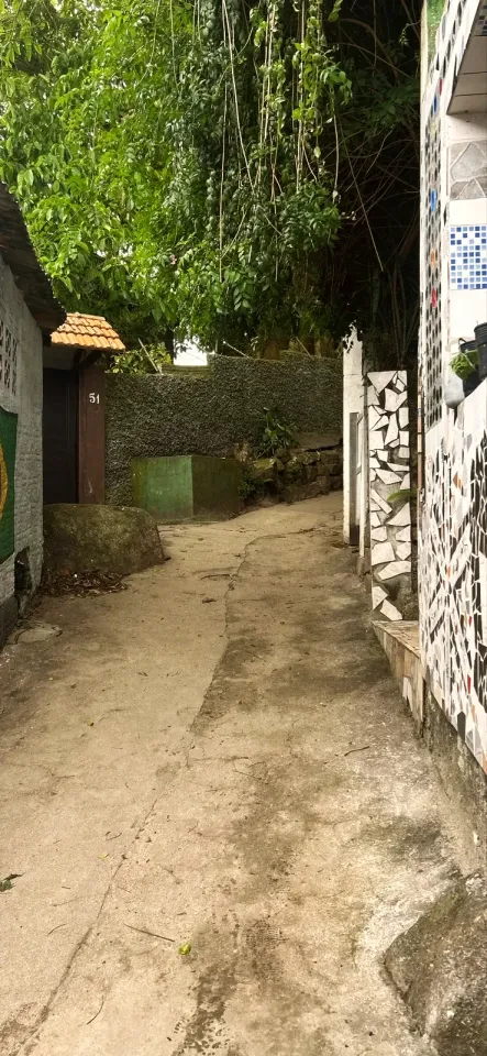
Narrow lane between mosaic walls, under trailing plants.
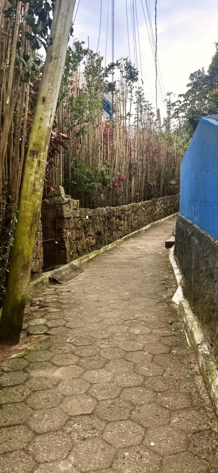
Hexagonal paving between a stone wall and a blue wall.
Shady earth path between tall bamboo and dense forest.
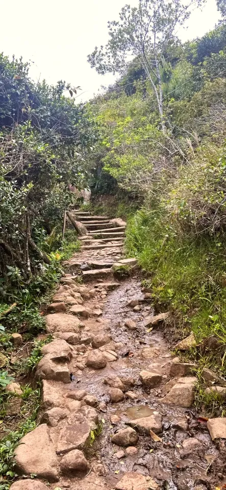
Uneven stone steps climb between low vegetation on the hillside.
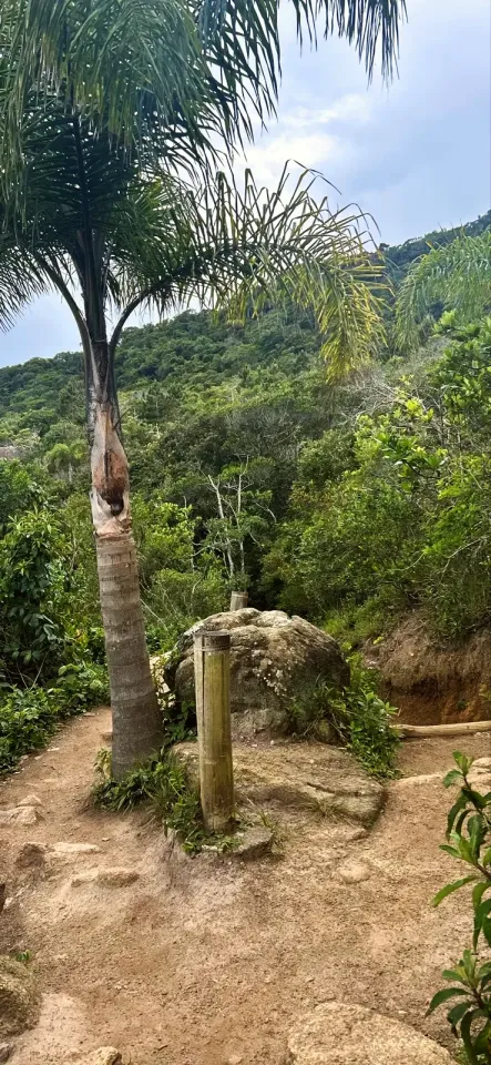
Narrow trail passes a palm and a short post beside a boulder.
Angular wooden bridge crosses a forested valley next to a large tree.
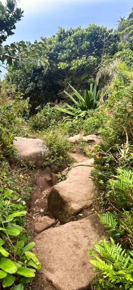
Large, irregular boulders form the final descent through the shore vegetation.
The blue suspension bridge over the Barra da Lagoa channel marks the start of the walk.
Prainha da Barra da Lagoa from above: kiosks, parasols and the rocky shore in front of the sea.
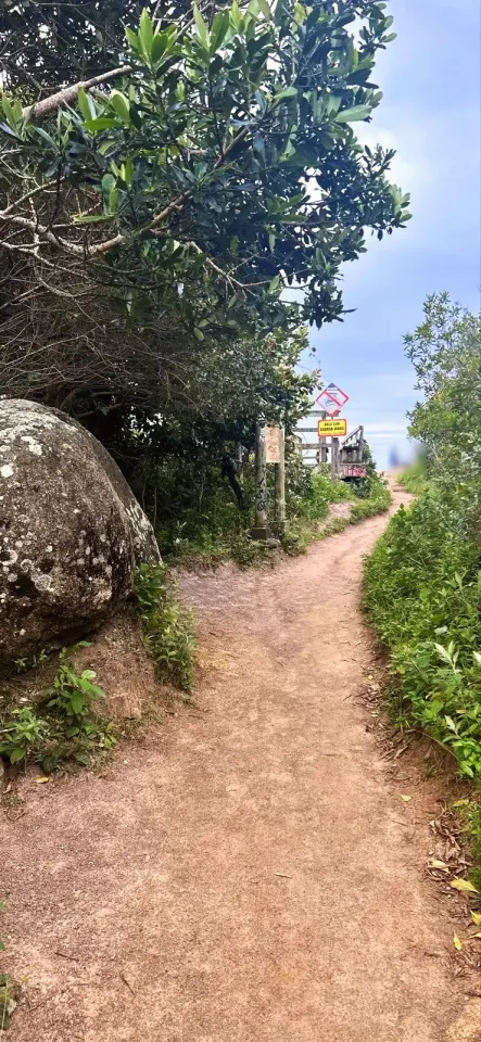
Earth trail passes a boulder to the ÁREA SEM GUARDA-VIDAS (no lifeguard) signs at the start of the lookout.
From the Mirante das Piscinas Naturais, granite boulders above the sea and islands in the distance.
Starting point: the suspension bridge over the channel, at the end of Rua Amaro Coelho. Buses to Barra da Lagoa stop near the bridge (check the route before you set off); cars and ride-hailing cars stop in the village. Walk back the same way. Parking not checked.
Trainers with grippy soles, water, sunscreen and a cap (no shade on the rocks), downloaded route map. A sling or carrier for babies: pushchairs cannot get through. A bag to carry your rubbish back.
Uneven steps, mud after rain and slippery rocks on the shore. No lifeguard on duty: with a north-easterly wind the sea gets rough quickly and the depth reaches 10 ft near the rocks. Keep children within arm's reach, away from the wet edge.
0.6 mi · 25 min
One way to the rocky shore; walk back the same way. No car access at the end.
Out and back · 1.2 mi · 50 min
Walk to the rocky shore and return on the same trail to the suspension bridge: about 1.2 mi and about 1 hour without a long stop.
Updated from the same shared observations as the map and app. Distances follow the main walk, including the return.
Reports are observations, not a guarantee. Coverage varies by carrier and conditions. Download the map before leaving.
Start beside the blue footbridge; cross on foot towards the village lanes.
Granite shore at the end of the footpath. Return along the same path; no road pick-up.
Parking and taxi information reflects the recorded observation. Check current access and prices before leaving.
No parking or taxi locations verified yet.
From the suspension bridge to the rocky shore we measured 0.6 mi, or about 1.2 mi there and back. Other guides give 1 970 ft to 2 720 ft because they count from the Prainha or another point.
They are sea pools between the granite boulders of the rocky shore, next to Ponta da Galheta in Barra da Lagoa. They only stay calm when the sea is calm; with waves, surf batters the shore.
Only when the sea is calm and if you can swim: the depth reaches 10 ft near the rocks and there is no lifeguard. If in doubt, stay on the lookout.
No. The rocky shore is the turning point, and you return the same way to Barra da Lagoa.
No. There are steps in the lanes, stone steps in the forest and large boulders at the end; use a sling or baby carrier.
Collect it in person in the Boramundo app at Piscinas Naturais da Barra da Lagoa.
Mark a route after completing one full published walking option. Photos and GPS are not required. Repeats count once.
Sources and references: pmf.sc.gov.br, redeplanejamento.pmf.sc.gov.br, ocp.news, quantocustaviajar.com, viagensecaminhos.com, ndmais.com.br
In this first version, ratings are user opinions. Physical passage has not been verified.
See open group outings on this route or propose your own.