Skip to content

Trail from Lagoa Church to Rampa Voo Livre

1+ in a sling Out and back

A short trail from the Lagoa church up to the Rampa Voo Livre on Morro do Assopro: 1.0 km of forest climb to a view of Lagoa da Conceição, the dunes and the…

Share this trail with friends
Route with goalsStart, 1 goals and finish — share it or open in the app to start
Download PDF
Free offline summary
Distance
1.3 mi
Time
1 h
Climb ≈ 72 floors
↑ 720 ft
Difficulty
Category
Local
Field check

About the trail

A short trail from the Lagoa church up to the Rampa Voo Livre on Morro do Assopro: 0.6 mi of forest climb to a view of Lagoa da Conceição, the dunes and the sea.

Rampa Voo Livre trail at a glance

  • Distance: 0.6 mi to the ramp and 1.2 mi with the return the same way, measured on our 1 November 2026 recording.
  • Time: the climb took 25 minutes of walking. The descent was not timed; allow about an hour to go up, enjoy the view and come back.
  • Climb: about 710 ft, from the church at around 160 ft above sea level to the ramp at nearly 850 ft.
  • Difficulty: easy on the Boramundo scale. The scale counts each 330 ft of climb as 0.6 mi: 1.2 mi plus 710 ft make about 2.5 mi of effort.
  • Kids: from age 6 walking with an adult; adults have done the trail carrying children aged 1 and up in a sling.

This is the first kilometre of our Morro do Assopro traverse to Costa da Lagoa. Here the walk ends at the ramp and returns to the church; the full traverse carries on along the top of the hill and comes back by boat. The guides to the hill we read (Família na Trilha, Pegadas de uma Viagem, Mané Viajante and an Airbnb tour) start from Sertão do Assopro or the roadside lookout, not from the church.

Who's going

Nobody has planned this trail for the next 7 days yet.

Sign in to plan a hike or join one

Lagoa church trail step by step

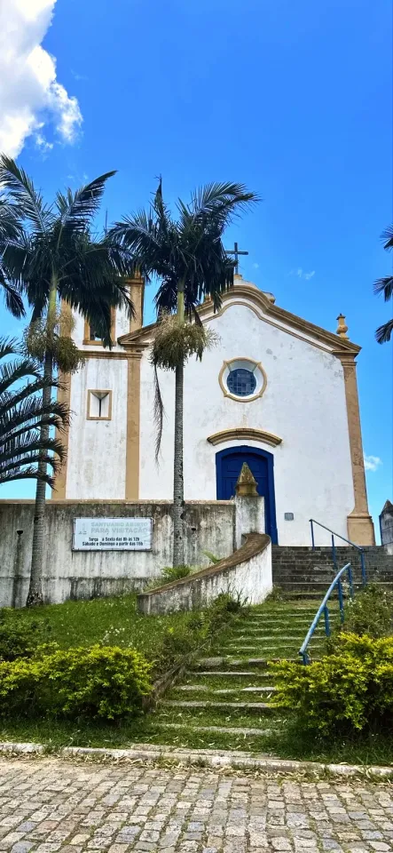
  1. The white church with blue doors and the visiting-hours sign on its wall.

    Church and cobbled lane (0–490 ft)

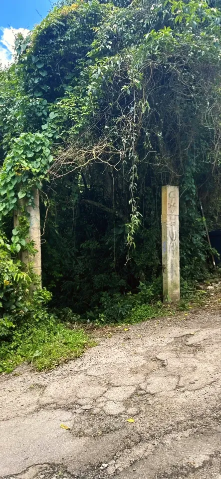
    Start at Capela de Nossa Senhora da Conceição da Lagoa, the white church with blue doors at the top of the stone steps. Walk up the cobbled lane past the Salão Paroquial do Santuário da Lagoa to two concrete posts half hidden by climbing plants: the trail starts there.

    • Entrance: the trailhead is marked on the map on this page.
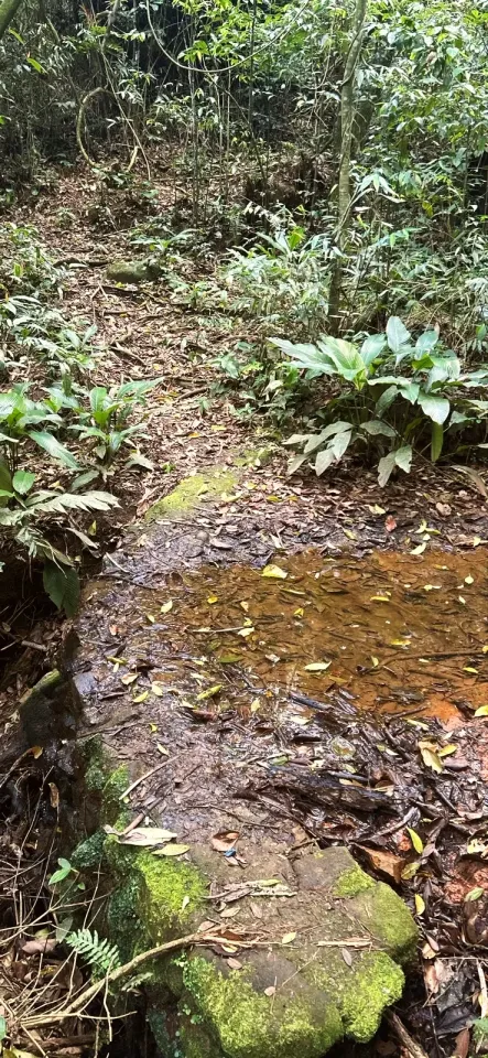
  2. The trail crosses the Riacho da Igreja on mossy stones just after the forest entrance.

    Into the forest and Riacho da Igreja (490–1 480 ft)

    The trail enters the shade and soon crosses a trickle of water over moss-covered stones. This is the Riacho da Igreja, a name that appears only on the OpenStreetMap map. Close by stands a small concrete-block niche with a little roof, covered in graffiti, in the middle of the forest.

    • Footing: step slowly on the mossy stone.
    • Water: the stream is not drinking water; bring your own.
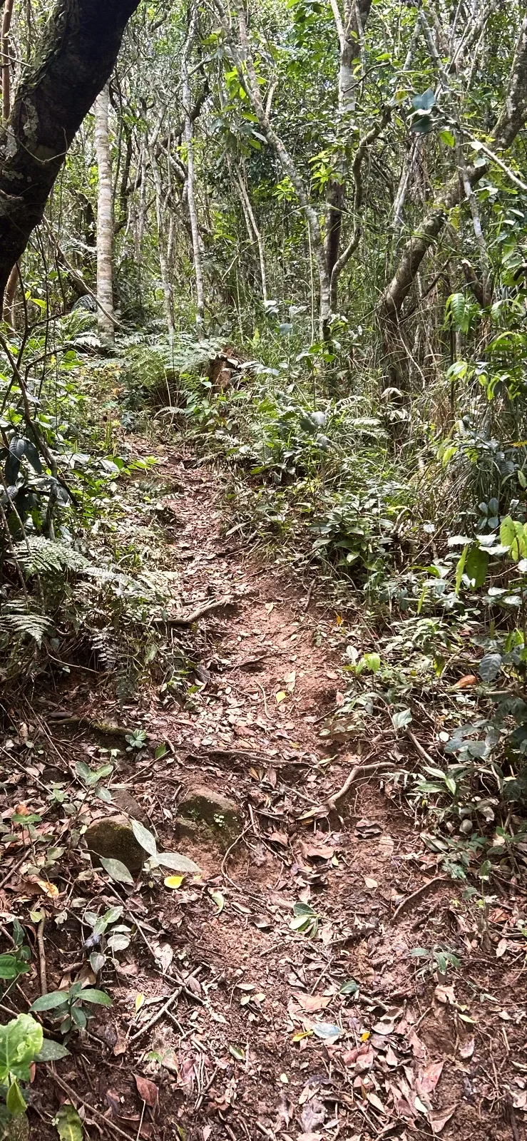
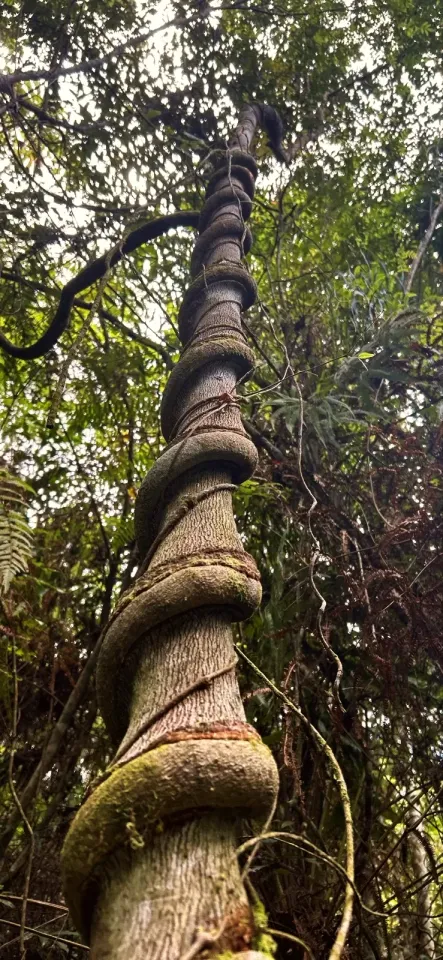
  3. A thick vine coiled around a tall trunk beside the climb, near 2 100 ft.

    Forest climb (1 480–3 120 ft)

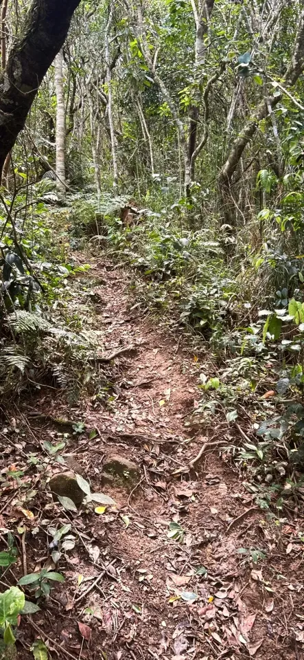
    The narrow path climbs between thin trunks, roots and dry leaves. Near 2 100 ft, a thick vine coils around a tall trunk beside the trail.

    • Pace: with children, stop at the turns and let people coming down pass.
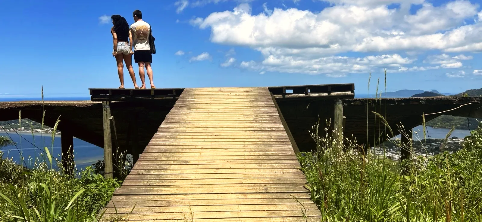
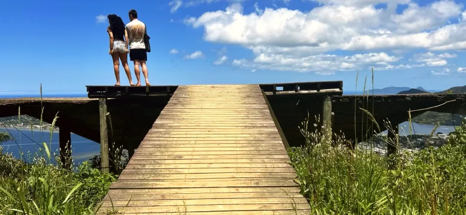
  4. The wooden deck of the Rampa Voo Livre, with no railing, above the lagoon.

    Rampa Voo Livre (3 120–3 340 ft)

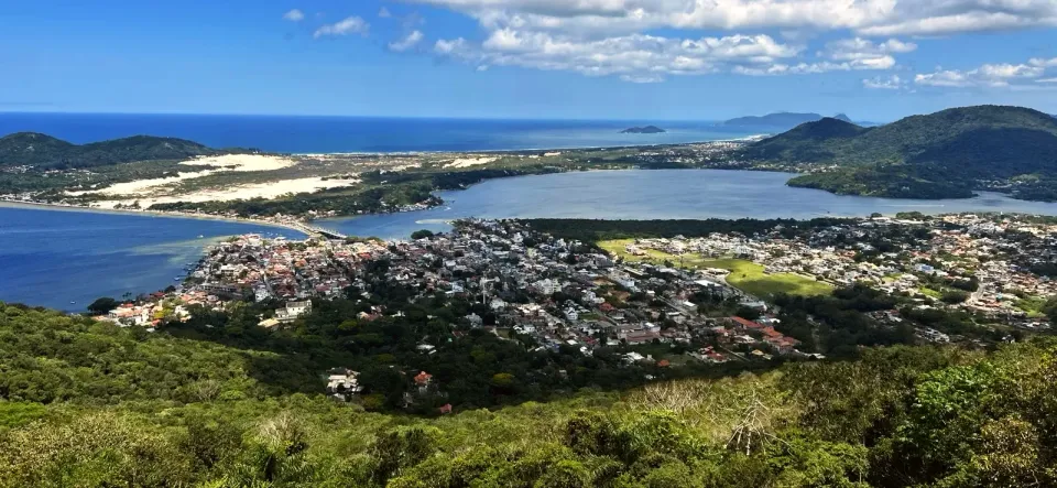
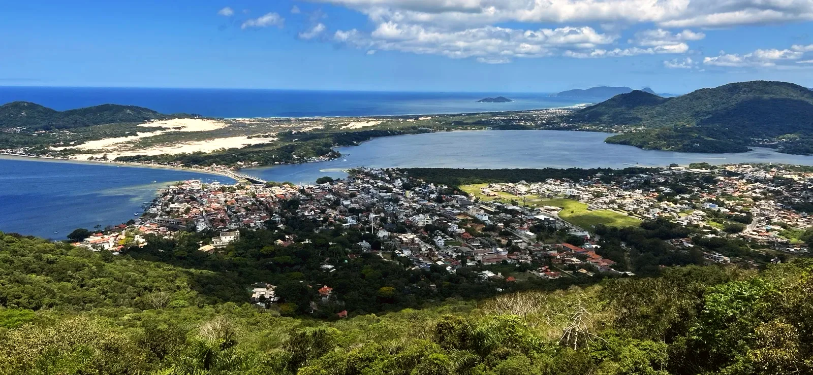
    The forest opens into a grassy clearing and reaches the Rampa Voo Livre, a concrete structure, its columns and slab overgrown with plants, topped with a wooden deck. From the tip of the ramp you see the village centre, Lagoa da Conceição, the pale dunes and the sea.

    • Edge: the ramp has no railing; hold children by the hand.
    • Return: walk back down the same trail to the church.

The Rampa Voo Livre and the view

Free flying (hang gliding and paragliding) has been practised at Lagoa da Conceição for more than 45 years, according to a 2023 request in the Santa Catarina Legislative Assembly. The same document mentions two take-off points: one for paragliders and a concrete ramp for hang gliders. The ramp on this trail, concrete with a wooden deck, is mapped as Rampa Voo Livre on OpenStreetMap.

We do not know who looks after the platform or what state the concrete and the wood are in. If someone is getting ready to fly, wait behind them and keep the tip clear. For Lagoa da Conceição, the flying site FlyAppi warns that the south wind can pick up very quickly: in strong wind, stay away from the edge.

The Mirante do Morro da Lagoa, on the SC-404 road, is a different place on the other side of the hill, reached by car.

Lagoa church and Nossa Senhora da Conceição

The Igreja Nossa Senhora da Conceição da Lagoa dates from 1780. It was listed as a heritage building in 1974, together with other churches on the island, and became a sanctuary in 1999, according to Visite Floripa. The stone paving of the churchyard is from the nineteenth century.

The sign on the wall reads "SANTUÁRIO ABERTO PARA VISITAÇÃO" ("Sanctuary open to visitors") and gives the visiting hours: Tuesday to Friday in the morning, Saturday and Sunday in the afternoon.

With kids and what to bring

Children from age 6 can walk the climb with an adult. Younger ones, from age 1, can ride in a sling: the walker confirms that adults have done the trail this way. The descent needs more care than the climb because of the roots and mossy stones. Plan to be back at the church in daylight.

Wear trainers or shoes with good grip and bring water for everyone, sunscreen for the clearing at the ramp and the map downloaded on your phone. We did not test mobile signal on this short walk. In rain, roots and stones get more slippery: pick a dry day.

Trail only

1.3 mi · 1 h

From the access point

1.3 mi · 1 h

Route features

  • Sea views: Yes
  • Lagoon views: Yes
  • Viewpoints: Yes
  • Photo spots: Yes
  • Slippery sections: Yes
  • Rocks: Yes
  • Narrow sections: Yes
  • Child age assessment: Under 6, assess individually
  • Child carrier: Yes
  • Shade: Mostly shaded
Views and experiences
Sea views
Yes
Lagoon views
Yes
Viewpoints
Yes
Photo spots
Yes
Surface and footwear
Slippery sections
Yes
Rocks
Yes
Narrow sections
Yes
Who it suits
Child age assessment
Under 6, assess individually
Child carrier
Yes
Stroller access
No
Conditions and access
Shade
Mostly shaded
Best time of day
Daylight
Safety
Avoid after rain
Yes

Route map

Full-page map
Show on the map

Zoom in to see photo thumbnails. Nearby photos form groups; larger groups reveal more as you zoom.

Map data from OpenStreetMap. It loads as you scroll to it.

Photos along the route

Swipe through the walk from start to finish; the open map follows each photo.

Phone checks and walkers’ reports: Internet 0.6 mi latest observation

Map legend

Access paths are gray, warnings red. Camera markers show where each photo was taken and which way it looks.

Places and zones

Places shown: 3

Capela de Nossa Senhora da Conceição da Lagoa

Rest stopObservedApproximate radius: 10 m

Church from 1780, white with blue doors at the top of the steps: start and finish of the walk. Sign on the wall: visits Tuesday to Friday 08:00–12:00, Saturday and Sunday from 15:00.

Get directions

-27.5982, -48.4679 · Observation date: · Source

Riacho da Igreja

Water pointPotentialApproximate radius: 10 m

Stream shown on the map, crossed on mossy stones just after the forest entrance. Not a drinking-water source.

A water point does not guarantee potable water or current availability.

Get directions

-27.5963, -48.4684 · Source

Rampa Voo Livre

ViewpointObservedApproximate radius: 10 m

Concrete ramp with a wooden deck on Morro do Assopro with no railing and a view of the lagoon, the dunes and the sea. Turnaround: wait behind anyone about to take off.

Get directions

-27.5914, -48.4716 · Observation date: · Source

Opens a 3D view with terrain from AWS Open Data, map tiles from OpenFreeMap and satellite imagery from MapTiler; these services receive your IP address.

The route in photos

Photos along the route. Open a photo to see it at full size.

Practical information

Access, transport and parking

Start and finish at Capela de Nossa Senhora da Conceição da Lagoa, in the Lagoa da Conceição village centre. The trail leaves the cobbled lane above the church between two concrete posts; you return the same way.

What to bring

Trainers or shoes with good grip, water for each person, sunscreen for the open clearing and the map downloaded on your phone. A sling for little ones who cannot walk the climb.

Risks and seasonal conditions

Roots, loose leaves and mossy stones on the way up and especially on the way down. The ramp's wooden deck has no railing and the state of the structure is unknown: keep away from the tip in strong wind or when someone is about to take off. Emergency in Brazil: SAMU 192, firefighters 193.

Ways to walk this route

Church to the ramp and back

Out and back · 1.3 mi · 1 h

1.2 mi there and back, about an hour in total. Climb to the Rampa Voo Livre and return to the church the same way. Children from age 1 in a sling or from age 6 walking with an adult. Bring water and the downloaded map.

Mobile internet

Updated from the same shared observations as the map and app. Distances follow the main walk, including the return.

Internet reported
1.3 mi

Internet reported at these distances from the start: 0 ft–1.3 mi.

Reports are observations, not a guarantee. Coverage varies by carrier and conditions. Download the map before leaving.

Getting there

  1. Capela de Nossa Senhora da Conceição da Lagoa

    Start and finish of the there-and-back walk: white church with blue doors at the top of the steps, in the Lagoa village centre.

    -27.59825, -48.46780
  2. Capela de Nossa Senhora da Conceição da Lagoa

    Start and finish of the there-and-back walk: white church with blue doors at the top of the steps, in the Lagoa village centre.

    -27.59825, -48.46780

Access, parking and taxi

Parking and taxi information reflects the recorded observation. Check current access and prices before leaving.

No parking or taxi locations verified yet.

Change log

  • route
  • route, photos, practical details, places on the route, description
  • route, photos, practical details, places on the route, description
  • route, practical details, description

Frequently asked questions

Where is the Rampa Voo Livre in Lagoa da Conceição?

The Rampa Voo Livre is on Morro do Assopro, 0.6 mi of trail behind the Lagoa church. The spot is marked on the map on this page.

How long does the trail from the Lagoa church to the ramp take?

The climb took 25 minutes of walking. With the return and a stop at the view, count on about an hour.

Can kids do the Rampa Voo Livre trail?

Yes, from age 6 walking with an adult, and from age 1 in a sling. At the ramp, which has no railing, hold children by the hand.

When is the Lagoa church open to visitors?

The sign on the wall says: Tuesday to Friday 08:00–12:00; Saturday and Sunday from 15:00.

Route token Opens on the spot

Collect it in person in the Boramundo app at Rampa Voo Livre.

Your walk

Mark a route after completing one full published walking option. Photos and GPS are not required. Repeats count once.

Sources and references: visitefloripa.com.br, portalelegis.alesc.sc.gov.br, flyappi.org, openstreetmap.org

Ratings and reviews

Write or edit your review

In this first version, ratings are user opinions. Physical passage has not been verified.

No ratings yet.
Walked this route? Share how it went to help others.

Who is going?

See open group outings on this route or propose your own.

Group outings