
Rio das Pacas
Water pointPotentialPoint
Map reference; drinking water and opening times not confirmed.
A water point does not guarantee potable water or current availability.
-27.7949, -48.5351 · Observation date: · Source
Solidão to Naufragados trail: 12.0 km along the south coast of Floripa, from Solidão beach past Saquinho to Naufragados beach and the lighthouse, finishing at…
Illustration based on our photos of this route
A full day or hands on rock.
On this route

Solidão to Naufragados trail: 7.5 mi along the south coast of Floripa, from Solidão beach past Saquinho to Naufragados beach and the lighthouse, finishing at Caieira.
This is the full traverse of the island's southern tip. It starts at Solidão beach, climbs the concrete path to Saquinho and crosses the forest and the open grassland above the sea to Ponta do Pasto. Then it drops to Naufragados beach, climbs to the lighthouse and leaves by the Caminho de Naufragados trail at Caieira da Barra do Sul. Apart from Saquinho and Naufragados there are no houses, and nowhere along the way is there confirmed treated water or a road.
Nobody has planned this trail for the next 7 days yet.
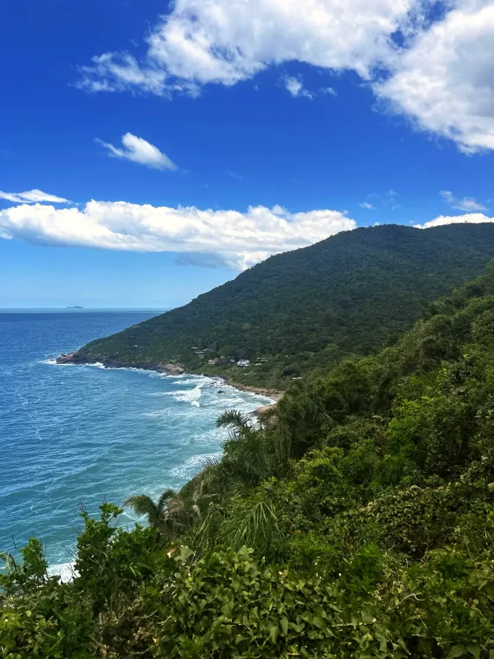
Leave from Solidão beach, the cove that maps call Praia do Rio das Pacas. Cross the bridge over the Rio das Pacas and take the concrete path uphill. Just after the bridge, the Cachoeira da Solidão trail branches off to the right. NSC Total puts the Cachoeira da Solidão waterfall about 1 310 ft away; that detour is not on our track. At around 1 480 ft the path passes above Ponta das Pacas, the rocky shore below. At 2 300 ft, at Mirante do Saquinho, the forest opens onto the sea and the houses of the community.
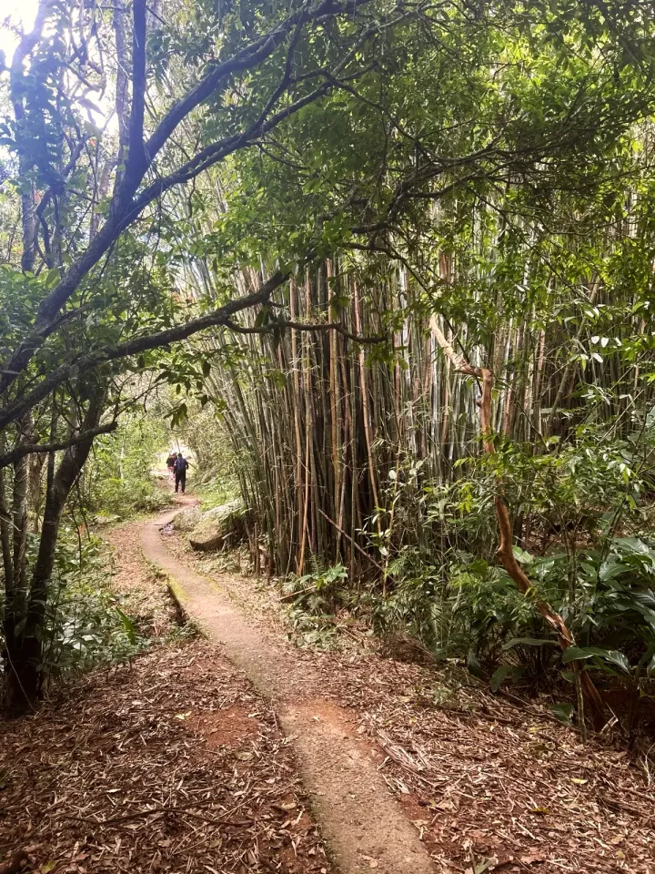
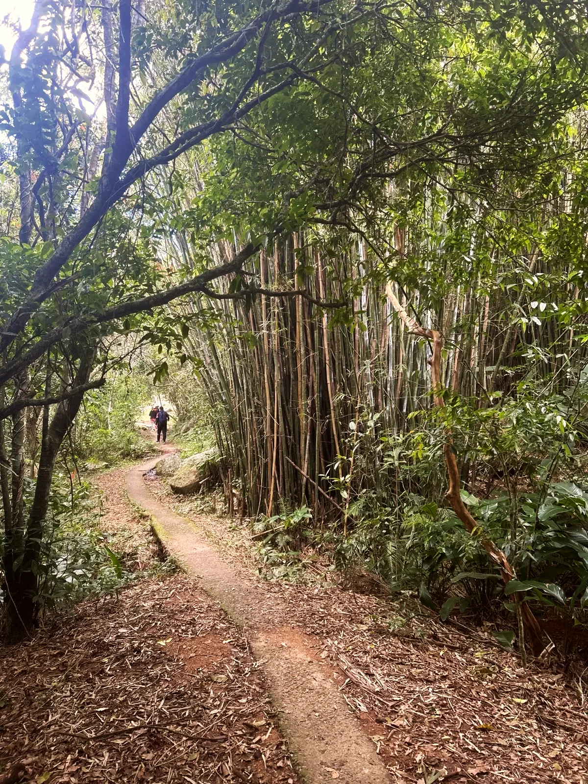
The concrete enters the Bambuzal do Saquinho, with a stream alongside, and drops between the houses. At 0.8 mi the short path to Saquinho beach leaves, about 160 ft below the trail. This is the beach of the Saquinho trail: if you only want the short walk, turn back here. Next come a plank bridge over a stream and the Bar Restaurante Saquinho on the map; do not count on it being open. South of the beach, Ponta do Saquinho closes the cove with rocky shores. The paving ends just after the last houses.
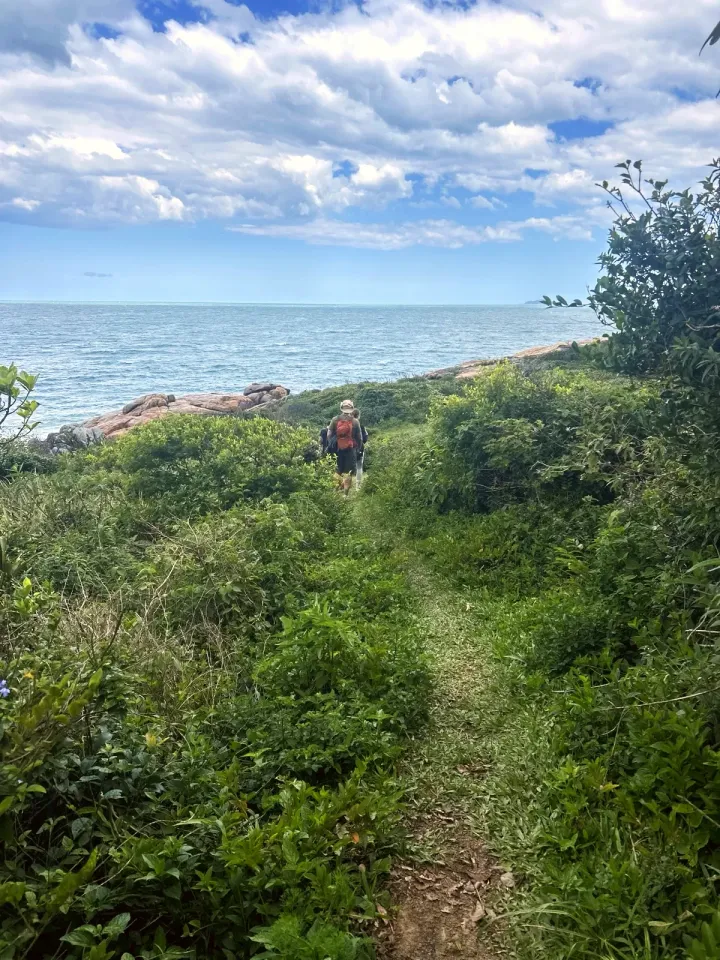
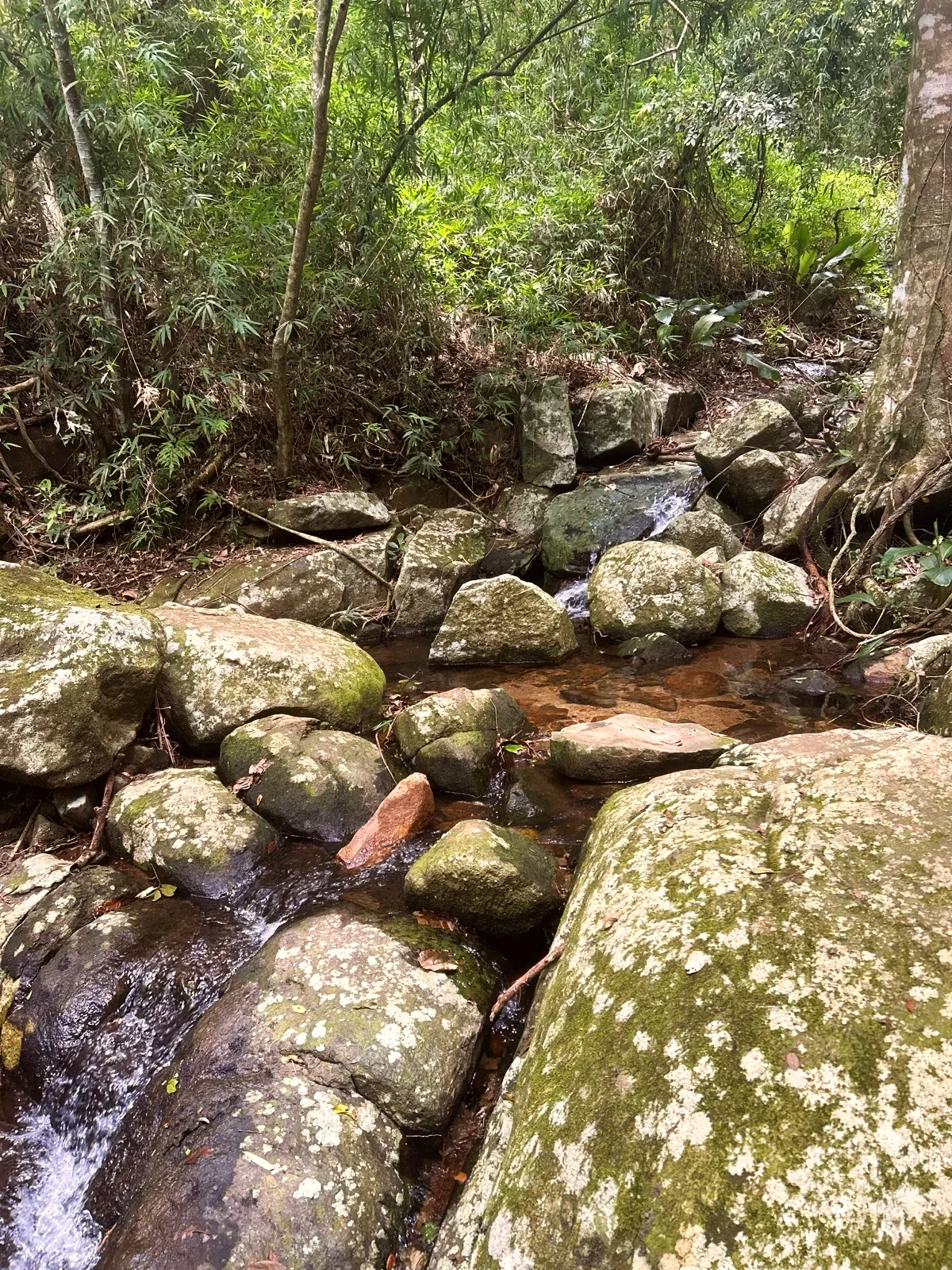
The trail turns to earth and roots. This is the longest stretch of forest: it climbs and drops, crossing rocky streams. At 1.6 mi the map shows the Trail toilet point, which we marked on the way, and at 1.8 mi the Forest cascade, a small fall between mossy rocks. Soon after, at the Coastal forest viewpoint, the sea comes into view. The map marks the Saco da Baleia cove shortly before Ponta do Pasto, the open grassland above the sea at around 2.9 mi. According to the Sul de Floripa guide, the name comes from the pasture and there may be cattle there; from it you can see the Ilhas Irmãs.
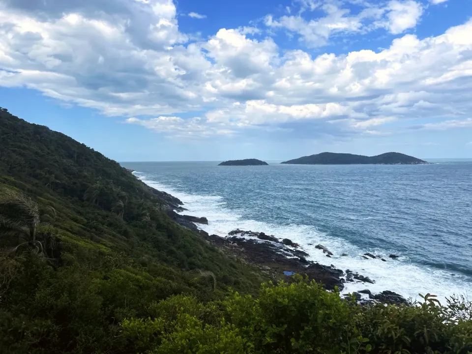
After the pasture the trail goes back into the forest and climbs the highest hill of the traverse, close to 590 ft. This is the densest stretch of forest: roots, loose leaves and stone steps. On the way down the rocky shore and the islands offshore come into view. On the east side of the beach is Ponta do Frade, which Guia Floripa calls Costão do Frade.
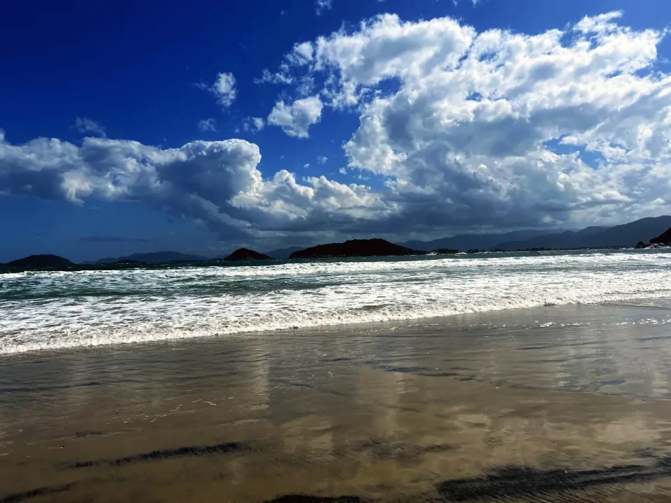
We came onto the sand at the Naufragados beach entrance we marked on the way; the map point is slightly off. The beach is open, with waves and a river running across the sand at the western end. Near the houses is the Capela Santa Luzia e São Pedro, a chapel. This is the place to rest before the last climb.
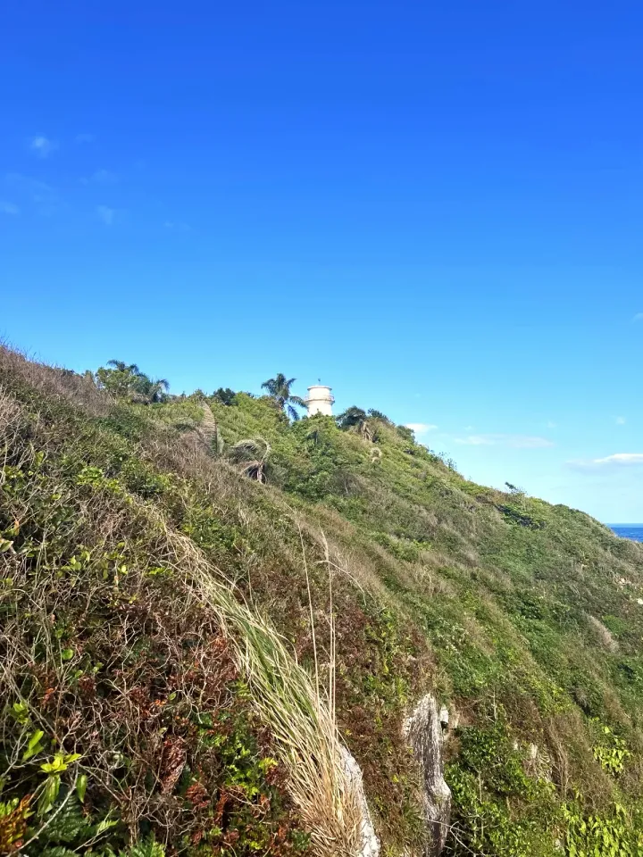
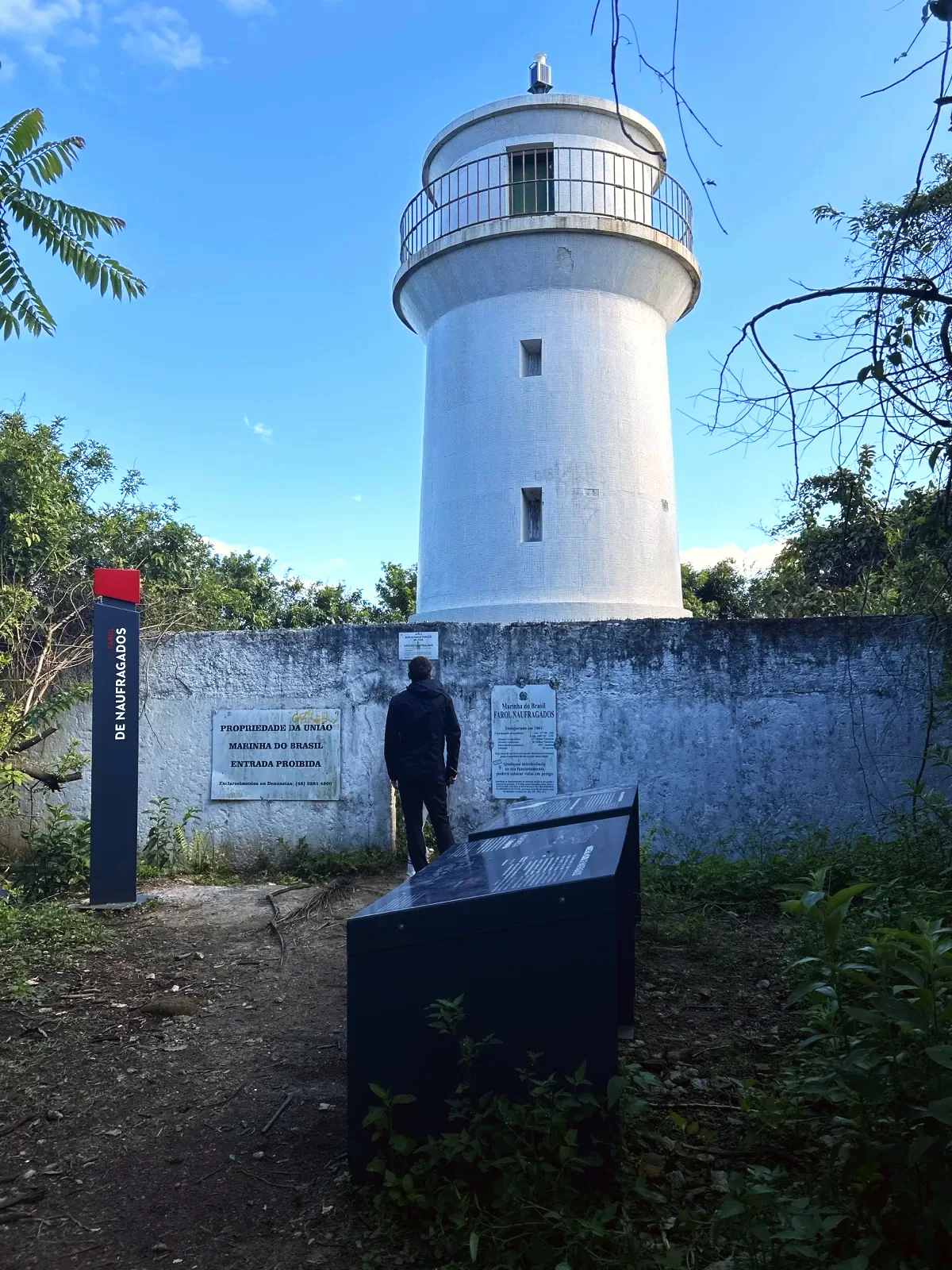
From the western end of the beach, a trail climbs to the Naufragados lighthouse. The white tower stands behind a wall with Navy signs: «ENTRADA PROIBIDA» (no entry) and «ACESSO CONTROLADO» (controlled access). You can only see it from outside. A panel beside it explains the name of the area: the southern entrance (Barra Sul) was «temida pelos navegadores desde os anos de 1500» (feared by sailors since the sixteenth century), and the shipwrecks gave the place its name. Carry on over the rocks to Ponta dos Naufragados, where you can see the entrance to the Baía Sul and the hills of the mainland.
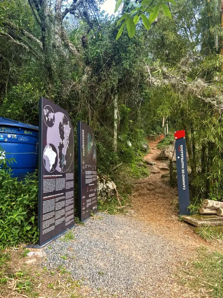
Go back down the lighthouse trail. At 5.8 mi it meets the sea at Portinho, a landing stage between rocks with the Army sign «ÁREA MILITAR PROIBIDA A ENTRADA» (military area, no entry). At around 6.1 mi, the sign points to CAIEIRA, PRAIA DE NAUFRAGADOS and F. MARECHAL MOURA. Forte Marechal Moura is on a side trail we did not take. Follow CAIEIRA: it is about 1.4 mi of forest, roots and an open field to the Caminho de Naufragados entrance, at the end of the road.
The trail starts and ends in different places, on opposite sides of the southern hills. Leaving the car at Solidão does not solve the return. The options are to arrange for someone to pick you up at Caieira or to take the bus from the Caieira da Barra do Sul terminus. Check the bus route and timetable before you set off: mobile data only appears at isolated points along the way.
In the opposite direction, from Caieira to Solidão, the track is the same, but the isolated stretch between Naufragados and Saquinho comes at the end of the day. The pickup is then at Solidão. Walking back the same way doubles the distance, to about 15 mi.
The sign at Caieira mentions boats that leave the moorings for Naufragados. We did not count on a boat: it depends on the sea and on a deal with a boatman, and this route is entirely on foot.
Start in the morning, in dry weather and with plenty of daylight to spare: we set off around midday and reached Caieira almost six hours later. The traverse takes the whole day, and the stretch between Saquinho and Naufragados has no easy way out. After heavy rain, roots and rocks get slippery and the streams rise. There is no shade on the Ponta do Pasto grassland or on the beach.
Bring water for the whole day, plus snacks, sun cream, a rain jacket, trainers or boots with good grip and a head torch. Download the map to your phone before you leave. Near the start we saw a dark, hairy spider, and the park sign warns: «Cuidado com cobras e outros animais peçonhentos» (beware of snakes and other venomous animals). Watch where you put your feet and hands.
The full traverse is not for young children: it is 7.5 mi with several climbs and an isolated stretch in the middle. Teenagers from 12 years old who are used to walking can go with an adult, with their own water and sturdy footwear. You cannot take a pushchair. With younger children, the concrete stretch to Saquinho beach is the short walk.
The Navy sign on the wall reads: «Inaugurado em 1861», the year it opened. It also gives a light range of 18 nautical miles and an elevation of 43 metres. The Forte Marechal Moura panel says construction began in 1909, to a design by Captain Pedro Maria Tromposky Taulois, and that the fort is now run by the Brazilian Army.
The old sign near the entrance at Caieira, covered in graffiti, still lets you read «Parque Estadual da Serra do Tabuleiro» and, more faded, the name of the APA do Entorno Costeiro protected area. The park was created in 1975 and, according to Wikipedia, includes the southern tip of Santa Catarina Island. The sea in front is part of the APA da Baleia Franca, created by decree on 14 September 2000 to protect the southern right whale; the decree's boundary runs to Ponta dos Naufragados. Between July and November the whales pass along this coast, and the Sul de Floripa guide reports seeing whales from Ponta do Pasto in August.
Naufragados is also a traditional fishing community. Stay on the paths, leave gates as you found them and take your rubbish home.
7.5 mi · 6 h
7.5 mi · 6 h
Zoom in to see photo thumbnails. Nearby photos form groups; larger groups reveal more as you zoom.
Map data from OpenStreetMap. It loads as you scroll to it.
Swipe through the walk from start to finish; the open map follows each photo.
Phone checks and walkers’ reports: Internet 1.4 mi Unstable 0.2 mi No internet 5.8 mi No data 0.2 mi latest observation
Coverage depends on the carrier and the weather. Grey dots: no observations yet.
Access paths are gray, warnings red. Camera markers show where each photo was taken and which way it looks.
The map or its tiles are unavailable. Route coordinates and information remain available as text.
Places shown: 24
Water pointPotentialPoint
Map reference; drinking water and opening times not confirmed.
A water point does not guarantee potable water or current availability.
-27.7949, -48.5351 · Observation date: · Source
ViewpointObservedPoint
Checked against the recorded walk and the field photos.
-27.8005, -48.5352 · Observation date: · Source
Rest stopObservedPoint
Bamboo grove and nearby water mentioned in a geotagged voice note. Water quality not checked.
-27.8024, -48.5379 · Observation date:
CaféPotentialPoint
Map point; opening hours not confirmed.
-27.8055, -48.5370 · Observation date: · Source
ToiletsObservedPoint
Marked by the walker on 18/10/2026; current facility not confirmed.
-27.8128, -48.5390 · Observation date:
WaterfallObservedPoint
Small waterfall marked by the walker on 18/10/2026; no confirmed drinking water.
-27.8157, -48.5412 · Observation date:
ViewpointObservedPoint
Opening onto the sea recorded in the walker's voice note.
-27.8161, -48.5408 · Observation date:
BeachObservedPoint
Beach crossed on the walk; a river flows out at the western end. No known lifeguard.
-27.8348, -48.5605 · Observation date: · Source
BeachObservedPoint
Correct entrance marked by the walker; the OSM point is off.
-27.8350, -48.5598 · Observation date:
Rest stopPotentialPoint
Community chapel mapped beside the path; not photographed.
-27.8331, -48.5611 · Observation date: · Source
LighthouseObservedPoint
Navy lighthouse opened in 1861 (sign on the wall). Military area: outside visits only.
-27.8357, -48.5698 · Observation date: · Source
ViewpointObservedPoint
Open headland next to the lighthouse, with views of the sea, the islands and the mainland.
-27.8358, -48.5708 · Observation date: · Source
ViewpointPotentialPoint
Fort begun in 1909, the island's last fortification (sign on site); signposted side trail, not walked.
-27.8341, -48.5688 · Observation date: · Source
Rest stopObservedPoint
Start and finish: trail post and official signs with a map, opening hours and advice.
-27.8163, -48.5610 · Observation date: · Source
ViewpointObservedPoint
The concrete path passes above Ponta das Pacas, the rocky shore as you leave Solidão.
-27.7983, -48.5349 · Observation date: · Source
ViewpointPotentialPoint
South of the beach, Ponta do Saquinho closes the cove with rocky shores.
-27.8082, -48.5358 · Observation date: · Source
ViewpointPotentialPoint
Shortly before Ponta do Pasto, the map marks the Saco da Baleia cove.
-27.8294, -48.5446 · Observation date: · Source
ViewpointObservedPoint
Open grassland above the sea with a view of the Ilhas Irmãs; the name comes from the pasture, and there may be cattle.
-27.8300, -48.5454 · Observation date: · Source
ViewpointPotentialPoint
Ponta do Frade closes the east side of Naufragados beach; Guia Floripa calls this rocky shore Costão do Frade.
-27.8385, -48.5603 · Observation date: · Source
BeachObservedPoint
Start of the walk; on OpenStreetMap it appears as Praia do Rio das Pacas.
-27.7947, -48.5348 · Observation date: · Source
WaterfallPotentialPoint
End of the mapped Cachoeira da Solidão trail (OSM way 524155698); a branch we did not walk.
-27.7942, -48.5380 · Observation date: · Source
BeachPotentialPoint
Mapped end on the beach via concrete access 464229380; not a recorded visit to the beach.
-27.8040, -48.5371 · Observation date: · Source
Bus stopPotentialPoint
End of the Caieira da Barra do Sul bus route, next to the entrance; check the timetable.
-27.8162, -48.5617 · Observation date: · Source
ViewpointObservedPoint
Landing stage between rocks with the BARCO PORTINHO post; next to it, a military area with no entry.
-27.8333, -48.5705 · Observation date: · Field photos, 18/10/2026
Opens a 3D view with terrain from AWS Open Data, map tiles from OpenFreeMap and satellite imagery from MapTiler; these services receive your IP address.
The map or its tiles are unavailable. Route coordinates and information remain available as text.
Elevation estimated from open terrain data (Mapzen Terrain Tiles on AWS Open Data: SRTM, Copernicus and others).
Photos along the route. Open a photo to see it at full size.
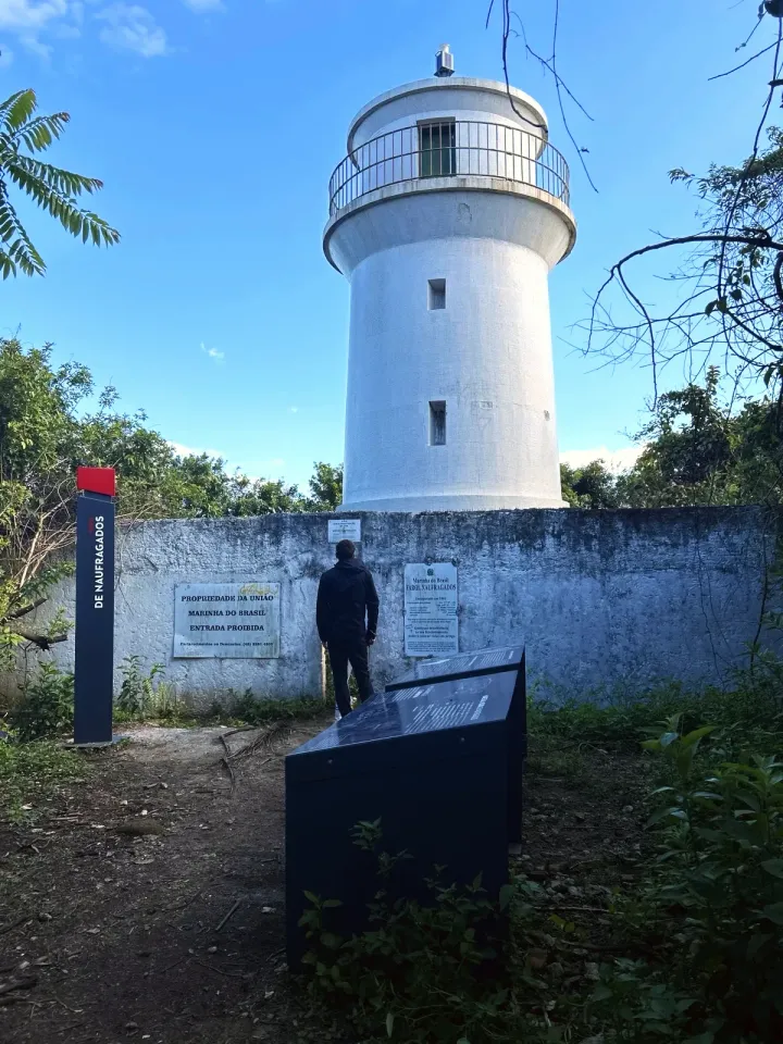
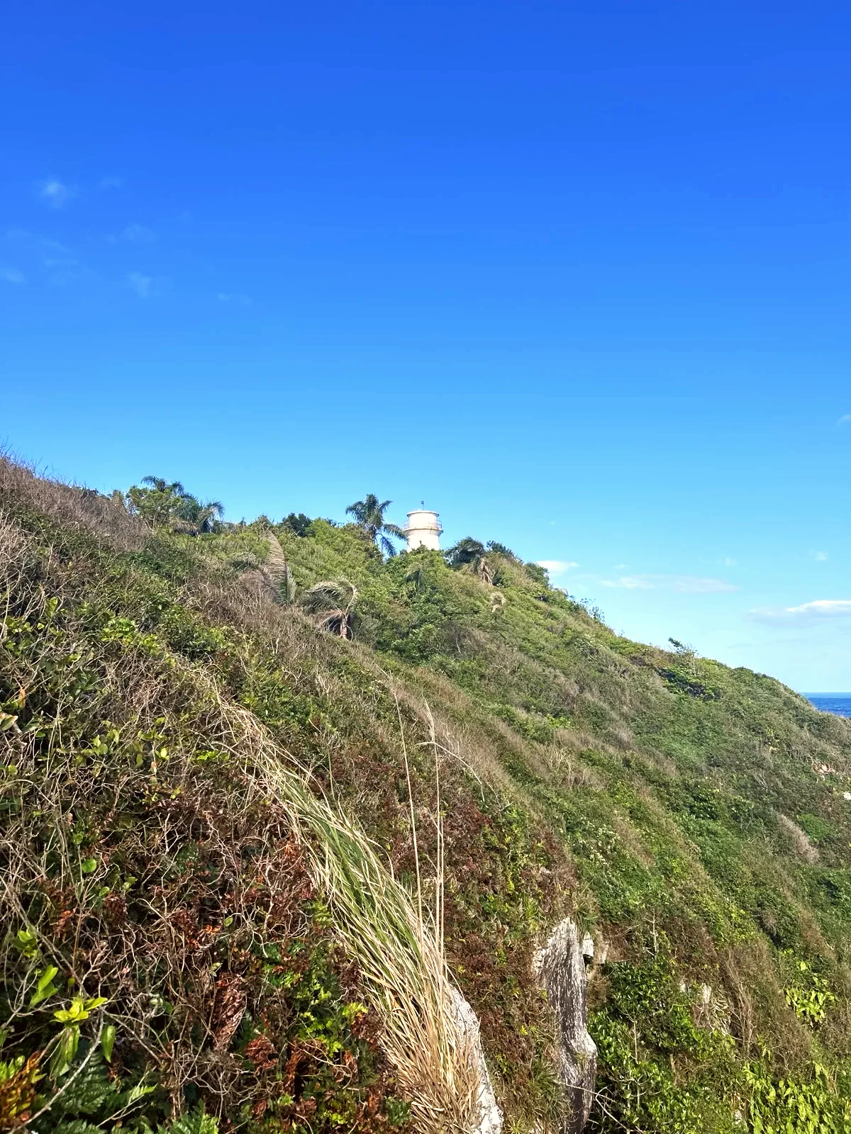
The Naufragados lighthouse, a white tower with a circular gallery, behind the wall with the Navy signs.
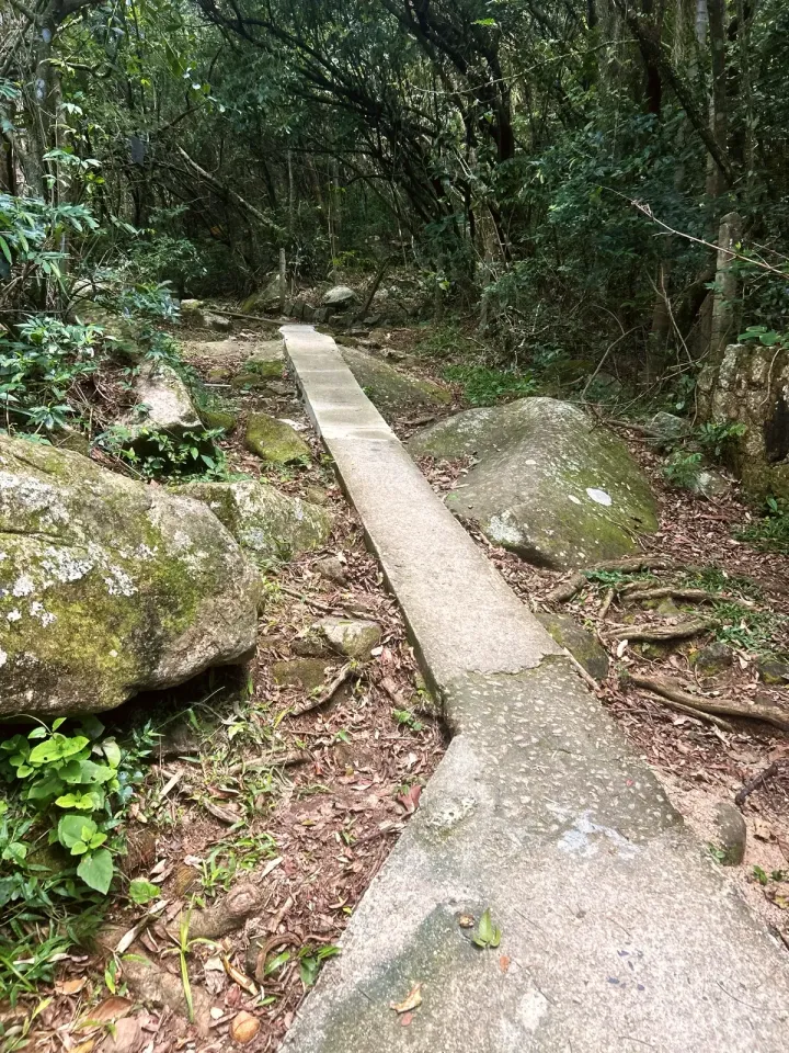
Narrow concrete path between forest boulders, on the climb to Saquinho.
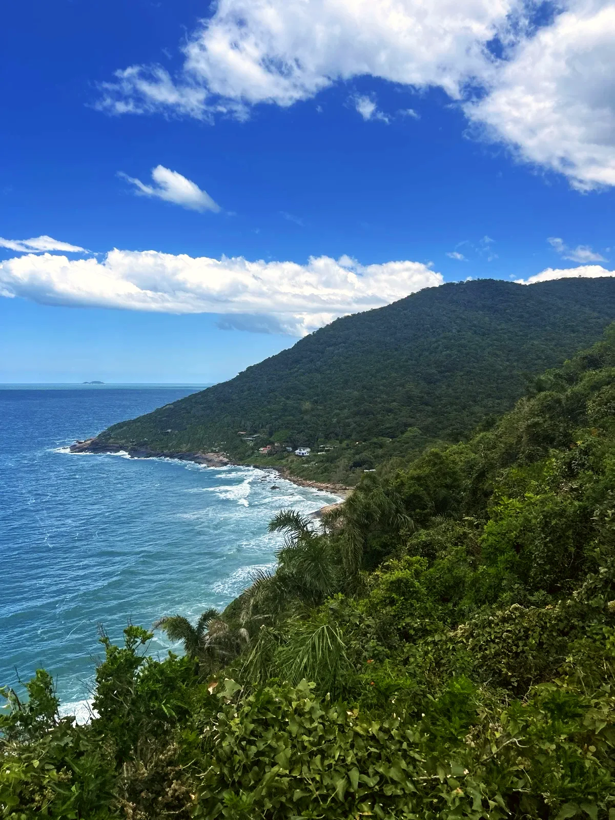
The Saquinho coastline and the houses below the forested hill.
Narrow concrete path through the Saquinho bamboo grove.
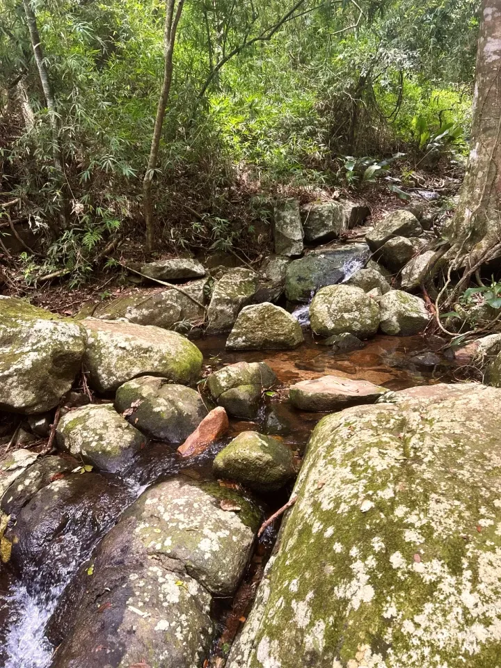
Stream between mossy rocks in the forest, near the small cascade.
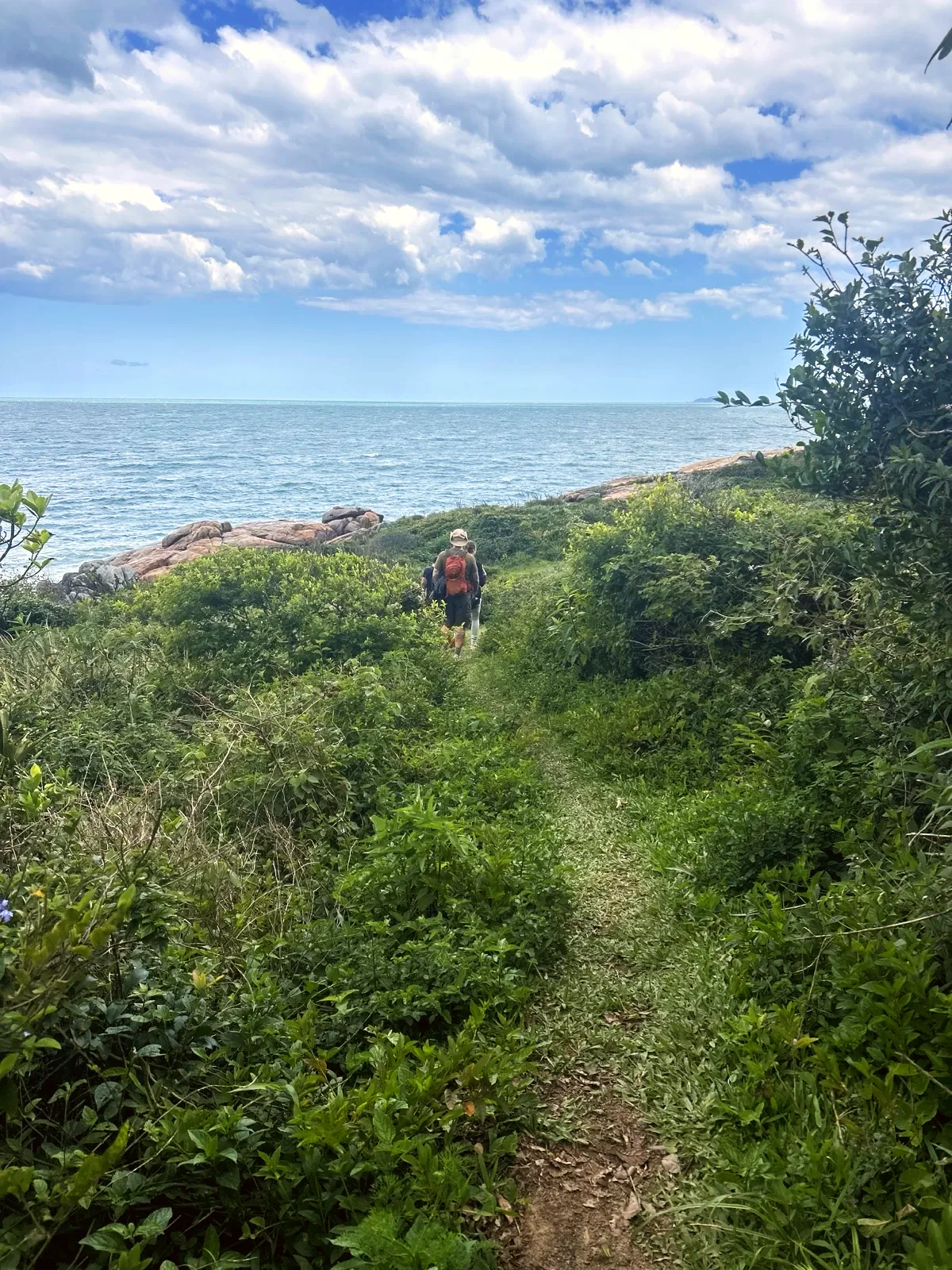
Grassy path across the Ponta do Pasto grassland, heading down towards the rocks and the open sea.
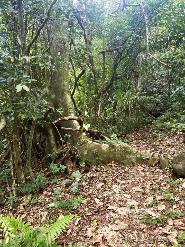
Narrow trail of earth, roots and leaves in the forest after Ponta do Pasto.
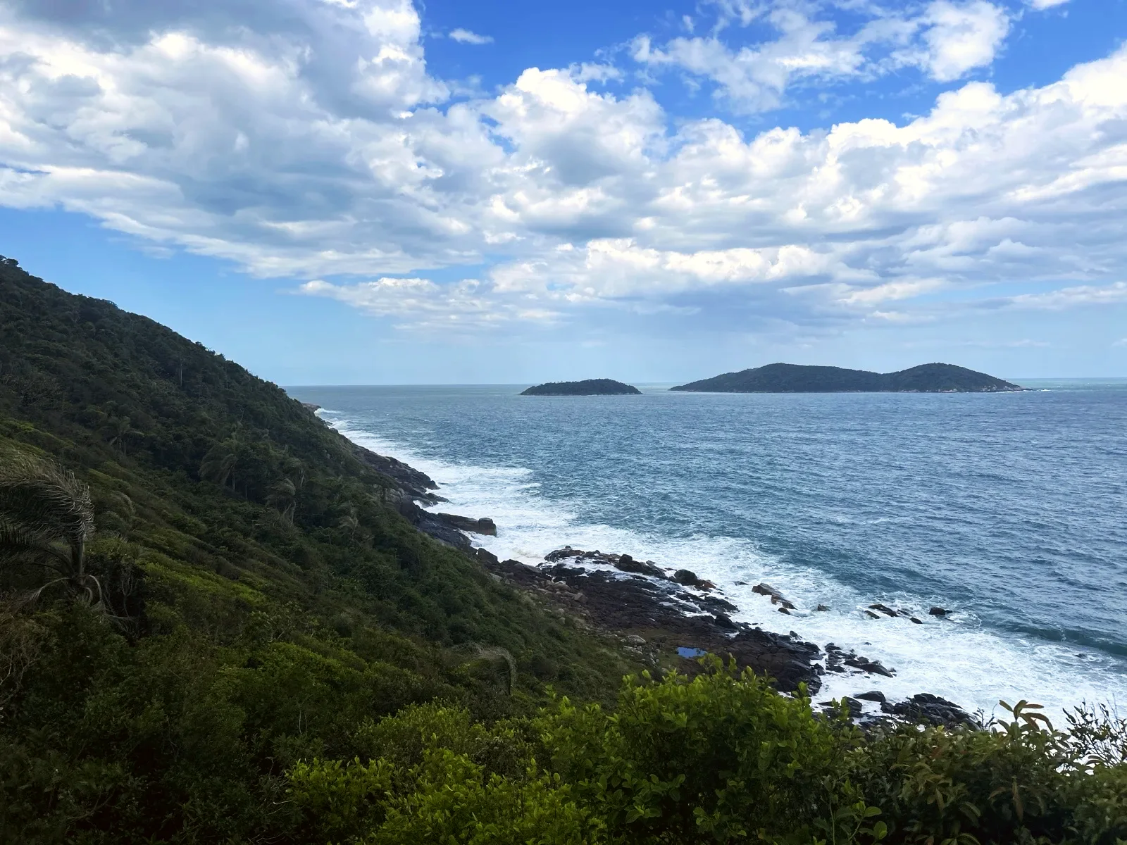
Rocky shore and offshore islands on the descent to Naufragados.
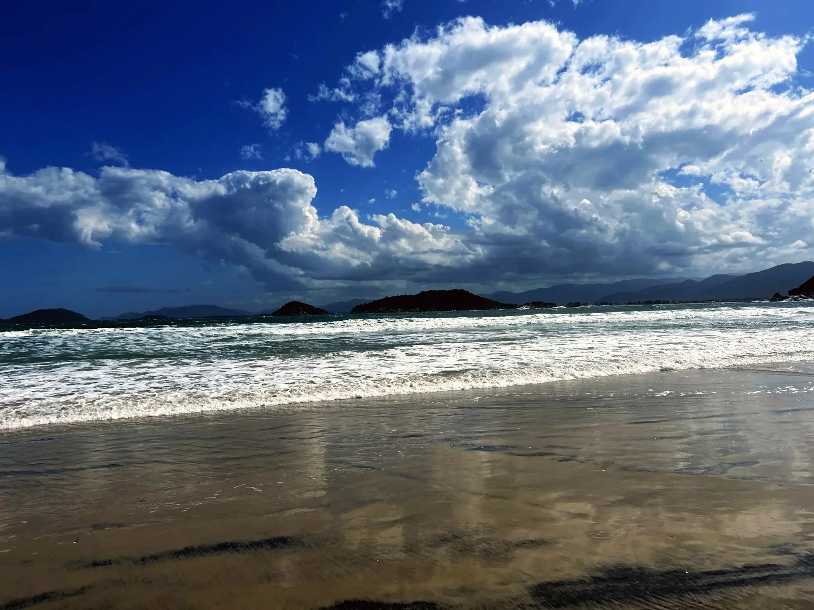
Waves washing onto the wet sand of Naufragados beach, with islands behind.
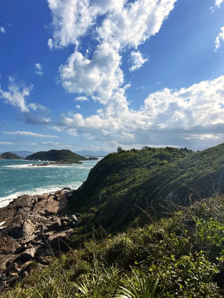
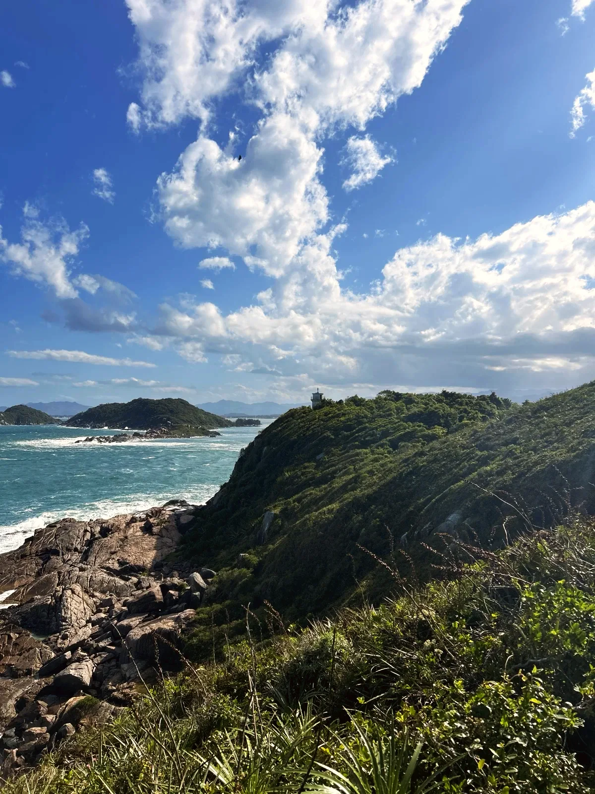
Ponta dos Naufragados with the forest, the rocky shore and the small lighthouse on top.
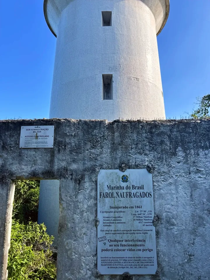
The Navy sign of the Farol Naufragados on the wall, with the narrow opening beside it.
The lighthouse on top of Ponta dos Naufragados, seen from the slope; the sea is on the right.
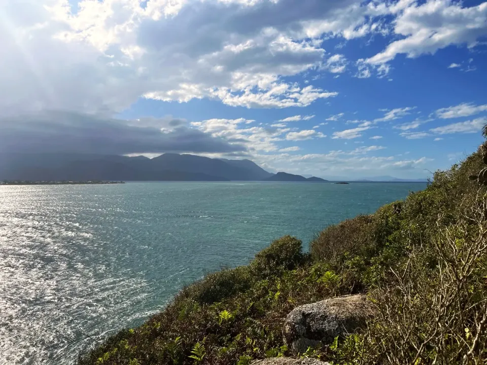
The sea and the hills of the mainland seen from Ponta dos Naufragados.
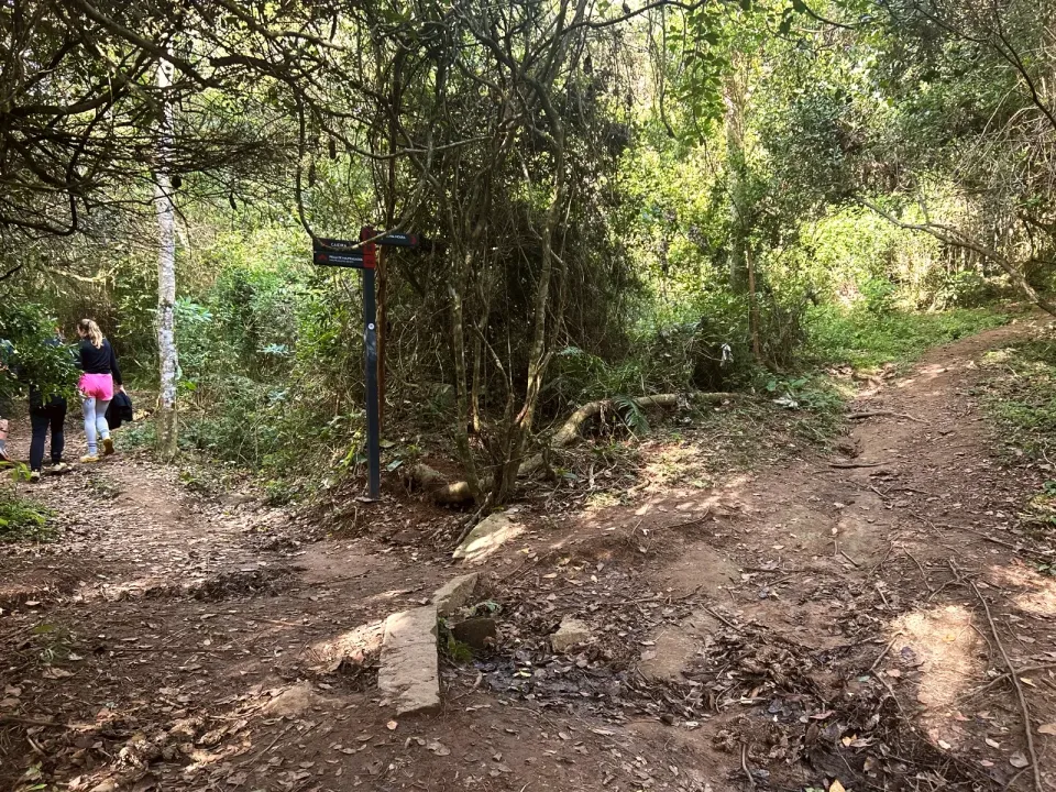
Sign in the forest, 1.4 mi from Caieira: CAIEIRA, PRAIA DE NAUFRAGADOS and F. MARECHAL MOURA.
The Caminho de Naufragados entrance at Caieira, with the trail post and the official signs.
Start at Solidão beach, next to the bridge over the Rio das Pacas; finish at the Caminho de Naufragados entrance, at the end of Rodovia Baldicero Filomeno, in Caieira da Barra do Sul. These are different neighbourhoods: arrange your return in advance. The Caieira bus terminus is next to the entrance.
Water for the whole day, snacks, trainers or boots with grip, sun cream, a rain jacket, a head torch and the map downloaded to your phone. Rivers and streams have no confirmed drinking water.
Long, isolated traverse, with roots, rocks and earth that gets slippery after rain. The park sign warns of snakes and venomous animals, and there may be cattle on the Ponta do Pasto grassland. The lighthouse and Portinho are military areas: stay outside. Emergency: SAMU 192, Bombeiros (fire and rescue) 193.
7.5 mi · 6 h
One way only, finishing in another neighbourhood. Arrange your return from Caieira da Barra do Sul; walking back doubles the distance.
7.5 mi · 6 h
The same track in reverse. Start at Caieira and arrange a pickup at Solidão; download the map before you leave.
Updated from the same shared observations as the map and app. Distances follow the main walk, including the return.
Internet reported at these distances from the start: 0 ft–0.5 mi; 0.5 mi–0.6 mi; 2.9 mi–3 mi; 5.5 mi–5.5 mi; 6.8 mi–7.5 mi.
Reports are observations, not a guarantee. Coverage varies by carrier and conditions. Download the map before leaving.
End of the path beside the bridge over the Rio das Pacas; the concrete path continues to Saquinho.
Trail entrance at the end of Rodovia Baldicero Filomeno, next to the bus terminus.
Parking and taxi information reflects the recorded observation. Check current access and prices before leaving.
No parking or taxi locations verified yet.
The full traverse is 7.5 mi, from Solidão beach to Caieira, by way of Naufragados beach and the lighthouse. To Naufragados beach it is about 4.5 mi.
Allow about 6 hours with stops. Moving, it took us about 3 hours.
No. The Solidão to Naufragados trail ends at Caieira da Barra do Sul, in another neighbourhood.
No. The signs on the wall say «ENTRADA PROIBIDA» and «ACESSO CONTROLADO».
We only found rivers and streams, with no confirmed drinking water. Carry all the water you need for the day.
Collect it in person in the Boramundo app at Farol de Naufragados.
Mark a route after completing one full published walking option. Photos and GPS are not required. Repeats count once.
Sources and references: suldefloripa.com.br, guiafloripa.com.br, localtour.com.br, planalto.gov.br, pt.wikipedia.org, gov.br, openstreetmap.org
In this first version, ratings are user opinions. Physical passage has not been verified.
See open group outings on this route or propose your own.