
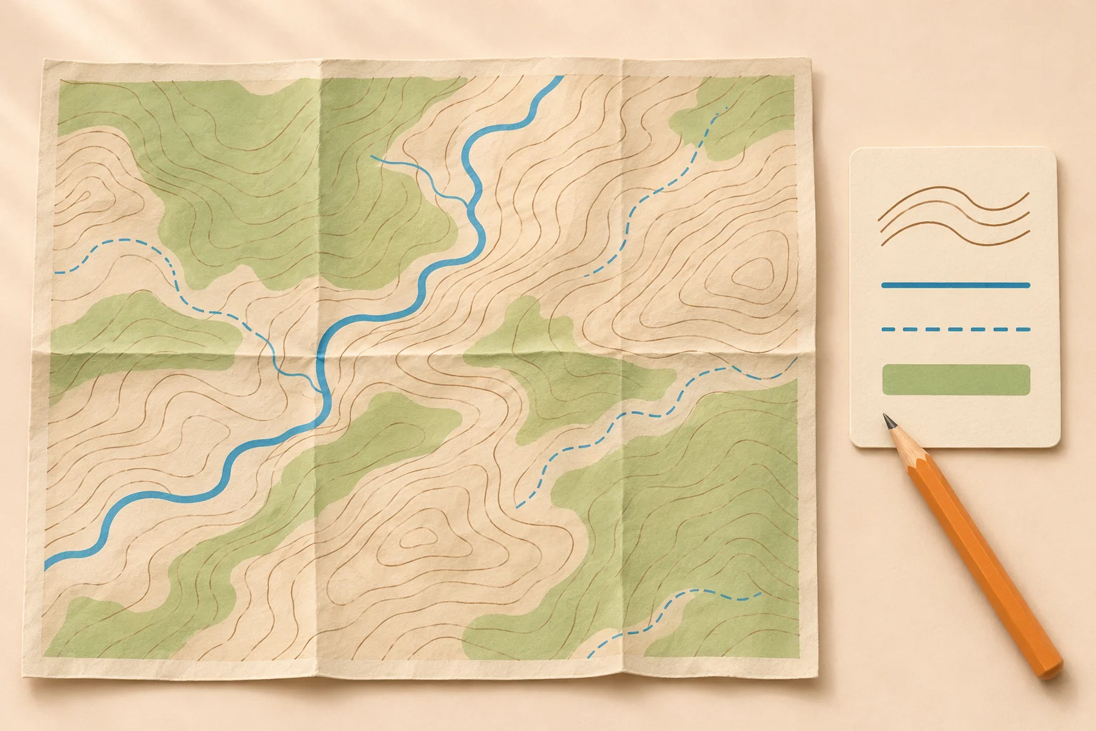
Topographic map symbols: what they represent
A small building may fit into a point symbol; a river follows a line; a lake covers an area. Contours add the shape of the land. They connect places at the same elevation and are not lines painted on the hillside.
For hiking, begin with the features along your proposed route. Identify the walking line, water crossings and terrain, then look for places that will help you recognize a junction. You do not need to memorize every industrial or survey symbol before your first walk.
This guide uses United States Geological Survey examples. The USGS symbol-sheet guide explains which references belong to which map generations. Outside the US, start with that country’s mapping agency and the legend printed on your sheet.
Find your topo map legend and map key
A map key, or legend, pairs sample marks with their meanings. “Conventional signs” means the agreed symbols used by a particular mapping system. The topo map legend is your reference when two thin lines look almost the same.
Read the map identity. Find the publisher, map series, scale and edition date in the margin or app’s map information.
Open the matching key. Use the printed legend, the PDF’s attached symbol sheet or the documentation for the selected app layer.
Compare more than color. Match the width, dash sequence, outline and nearby label. Zoom in enough to distinguish the pattern.
For US Topo PDFs published from 2013 onward, USGS says the symbol sheet is an attachment. Download the file and open its attachments panel in a PDF reader such as Adobe Acrobat. A browser preview may not expose it. Save the sheet separately if you will need it on a phone offline.
In a mapping app, changing the basemap can change the symbols while your recorded route stays visible above it. A bright route overlay has its own meaning. Check which marks belong to the underlying map before treating the overlay as evidence of a maintained trail.
Map colors: brown, blue, green, black and red
These map colors are common in USGS mapping, but color alone is a starting clue. Read the pattern and label too. A blue stream line and a blue water-pipeline line belong to the same broad water theme yet describe very different things.
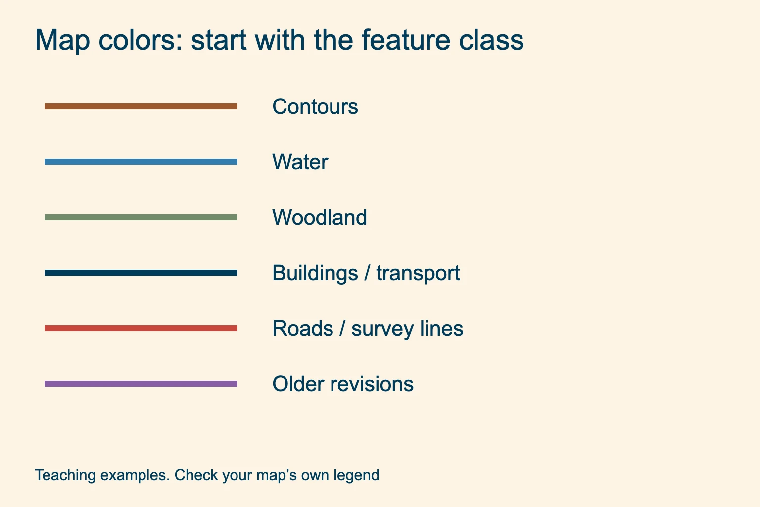
Brown: relief. Contours describe land elevation and shape. A heavier brown line is usually an index contour.
Blue: water features. Streams, lakes and springs use blue symbols; patterns distinguish their types.
Black and red: several classes. Roads, structures and boundaries need their exact line patterns or labels to identify them.
Green often marks woodland or other vegetation, depending on the pattern. On older sheets, gray or red area tint may indicate dense development. Purple can mark revisions on historic maps. It does not have that meaning on every modern map: the current US Topo guide also uses a purple line for a snow trail.
White space is not a promise of easy walking. The ground may still be rocky or steep. Low vegetation can also make walking difficult, even where no woodland tint appears. Aerial imagery shows photographed ground; shaded relief adds simulated light and shadow. Neither works as a flat woodland tint.
Water symbols: streams, springs and wetlands
A solid blue stream line represents a perennial stream in the US Topo guide. An interrupted blue line represents an intermittent stream. Perennial means the mapped flow category is normally year-round; intermittent flow occurs during part of the year. Neither category is a live report of what you will find today.
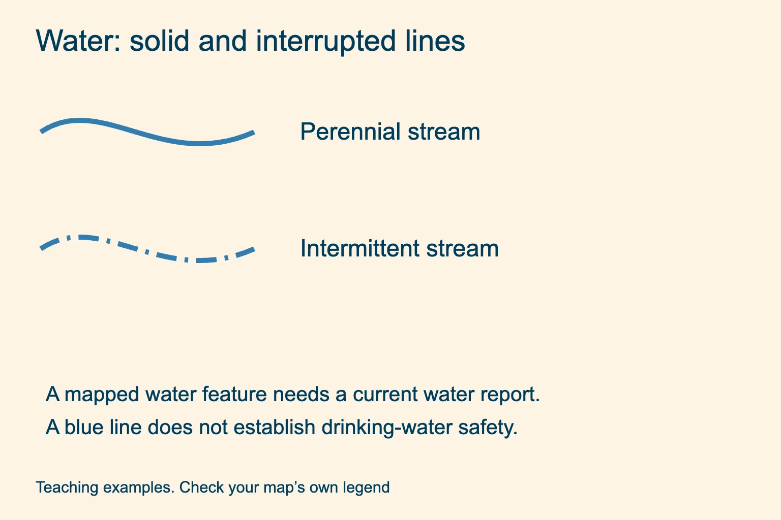
Interrupted line. Do not make a seasonal stream your only planned refill without a current report and a backup supply.
Spring or well. Match the blue point symbol in your legend. It locates a mapped feature, not a drinking-water tap.
Lakes can have solid water tint or seasonal patterns. Wetlands use repeated small marks, sometimes combined with vegetation tint. If your route crosses a stream, check the crossing itself and any bridge information.
Check water separately. A water symbol establishes neither safe drinking water nor a safe crossing. The National Park Service advises treating water collected from natural sources before drinking. Check current source availability and crossing conditions with the land manager.
The NPS backcountry health guide explains natural-water treatment. Our hiking water guide covers carrying enough for the walk.
Trail and road symbols, bridges and railroads
Trail and road symbols are especially easy to confuse on a small screen. A historical USGS sheet may show a trail as a black dashed line. In the current US Topo symbol guide, a land (“terra”) trail has a red-orange dash-dot pattern; snow and water trails have other styles. “Every dashed line is a hiking trail” is an unreliable rule.
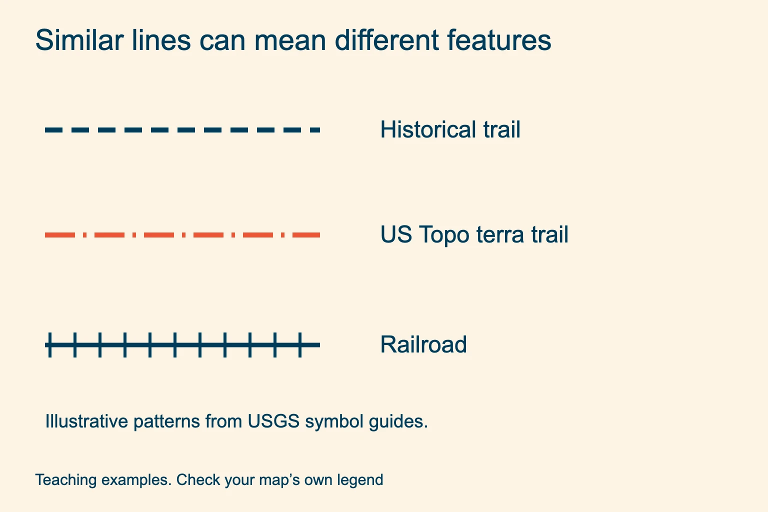
Trail versus road. Compare single and paired lines, width and dash pattern. A four-wheel-drive road has its own symbol.
Railroad. Short cross ties distinguish this example from a path. A railway is not a walking route.
A bridge symbol describes a crossing structure; it does not confirm that the bridge remains intact. A tunnel uses a different pattern. Where a trail merely crosses a blue line, do not assume a bridge exists. Check the land manager’s current route description before committing to that crossing.
Likewise, a drawn road can be gated or closed, and a mapped trail can be unmaintained. The Forest Service map resources provide a starting point for national-forest maps; consult the relevant forest’s alerts before travel.
Contour lines and the depression symbol
Contour lines connect equal elevations. The labeled, heavier index contours help you read heights; thinner intermediate contours fill the gaps. A supplemental contour adds detail and can be dashed. A dashed brown line therefore needs a different reading from a dashed trail.
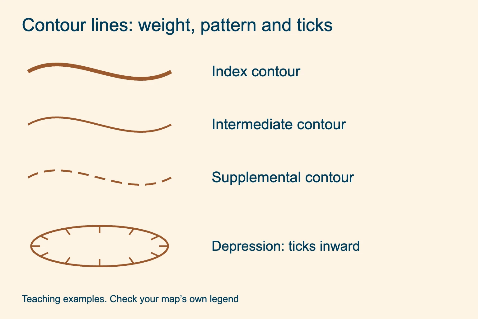
Depression. Short ticks, called hachures, point toward lower ground. On a closed depression they point inward.
Spacing. Close contours indicate a steeper slope than widely spaced contours on the same map.
Find the contour interval in the margin before counting elevation changes. Check the units too: feet and meters cannot be mixed. Do not assume every brown line marks one full interval when supplemental contours are present.
A closed ring alone can describe a hill. Read elevation labels and hachures to distinguish a depression. For valleys, ridges and a worked terrain example, continue with our guide to reading a topographic map.
Woodland, wetland and boundary marks
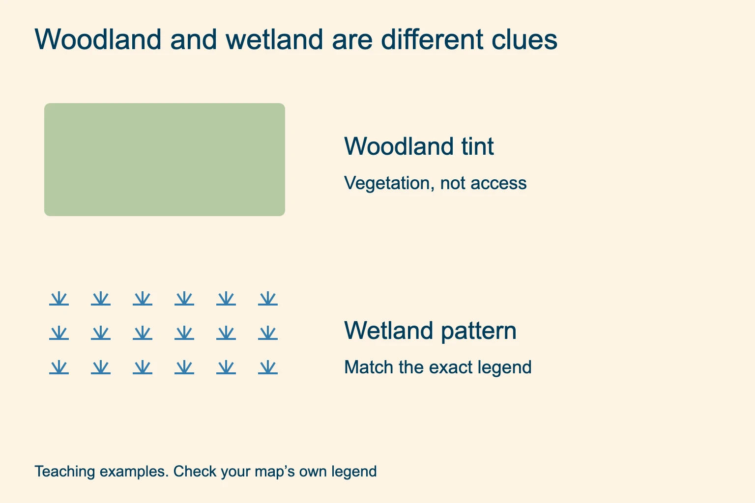
Woodland. A green area describes mapped vegetation. It does not establish public ownership or a clear route through the trees.
Wetland. Repeated water-related marks indicate a different feature from plain woodland tint. Check the precise category in the legend.
Boundary lines can mark a county, park, wilderness or another jurisdiction. Several use long and short dashes. Trace the line to its label and compare its pattern with the key instead of following it as though it were a trail.
A boundary is also different from a fence. The administrative line may have no visible marker on the ground. Confirm permitted access with the managing agency or owner; a green patch or a boundary on a general topo map does not grant permission to cross land.
Campground, school, mine and survey symbols
Point symbols save space. A tent-shaped campground mark identifies a mapped recreation feature, while a school or post office can be a useful landmark. Mine marks distinguish shafts from entrances; match the exact symbol before using it as a landmark.
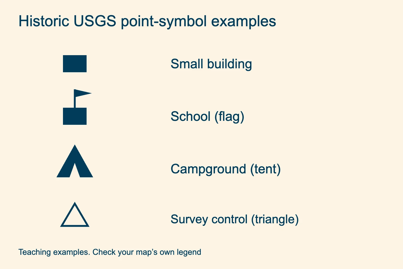
Buildings and services. Small black blocks on traditional sheets can be buildings. A school may have a flag; a house of worship may have a cross. Read labels such as PO or Cem with the matching historic key.
Campground and shelter. Look for the tent or shelter sample in your map’s legend. Check opening dates, reservations and rules separately. A symbol alone gives none of those details.
Mines and survey marks. Historic sheets distinguish shafts, prospects and mine or cave entrances. A triangle can be a survey-control symbol. Its complete shape and label matter; it is not automatically a summit or campsite.
A spot elevation is a height at a point. A benchmark relates to survey control and can carry a BM label on older maps. Neither is a contour line. Use the elevation unit stated on the sheet before comparing either number with nearby contours.
Power lines and pipelines have their own line symbols, which can resemble other long dashed features. Some are underground. Use the historical USGS brochure for the full set, including uncommon industrial marks. Look up unfamiliar symbols at home, while the full-resolution key is easy to read.
USGS map symbols PDF: current and historic keys
Choose the reference by the map you have. The US Topo map symbols PDF shows the current-series style, including colored trail classes and recreation symbols. The historical brochure linked above covers many traditional sheets and includes special symbols for certain editions.
USGS directs readers of maps published in 1947–2009 to that older brochure. Earlier historic maps need earlier instructions, linked from the agency’s symbol-sheet guide. For a 2010–2012 US Topo sheet, identify the series in the map margin and compare its marks with the US Topo guide. If a mark differs, ask USGS for the reference for that edition.
To get a map, open topoView, search the area and compare the available years and product types. Save the selected map with its matching legend. The topoView help guide explains the download formats and map metadata. An old sheet is useful for history, but check a current land-manager map for your hike.
Practice reading the symbols before your hike
Try this practice question without looking back at the contour section. Which group marks a depression: A or B?
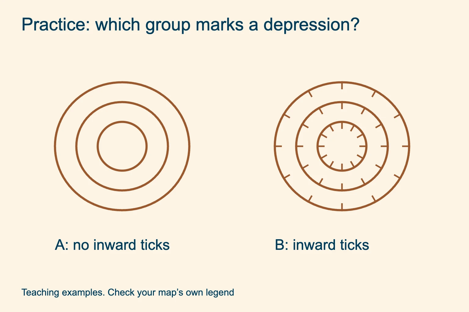
Look for the added marks. Both groups have closed rings. Only one has short lines pointing toward the center.
Show the practice answer
B. The inward-pointing hachures identify the lower ground inside the closed contours. A has no hachures; use elevation labels to confirm its shape on a real map.
Next, take your actual map and pick one line, one point symbol and one shaded area near the trailhead. Name each from the legend. Then compare them with the terrain in a familiar place. We recommend this small practice session before relying on a new map style in poor visibility.
Map symbol questions
What is a key on a map?
The key, also called the legend, explains the map’s symbols. It pairs sample points, lines and area patterns with their meanings. Use the key for the publisher, series and edition you are viewing.
Are all topographic map symbols the same?
No. Symbols vary by publisher, country, scale and edition. Even USGS has separate references for different map generations. Changing an app’s basemap can change the symbols without changing your route overlay.
What does each line on a topographic map represent?
First identify the kind of line. A contour connects equal elevations, while other lines can represent streams, roads, trails, boundaries or utilities. Color helps, but the exact dash pattern and label settle the meaning.
Is every dashed line a trail?
No. Dashed lines also appear in boundary, water, road, contour and utility symbols. Compare the complete line pattern with the map legend before following it.
Where can I download a printable legend?
Use the USGS PDFs linked above and select the one that matches your map generation. For US Topo PDFs from 2013 onward, also check the map’s attachments panel for its own symbol sheet. Save the reference before going offline.
Read the terrain behind the symbols. Put the legend beside your map, then connect contours and landmarks to the shape of the walk.